
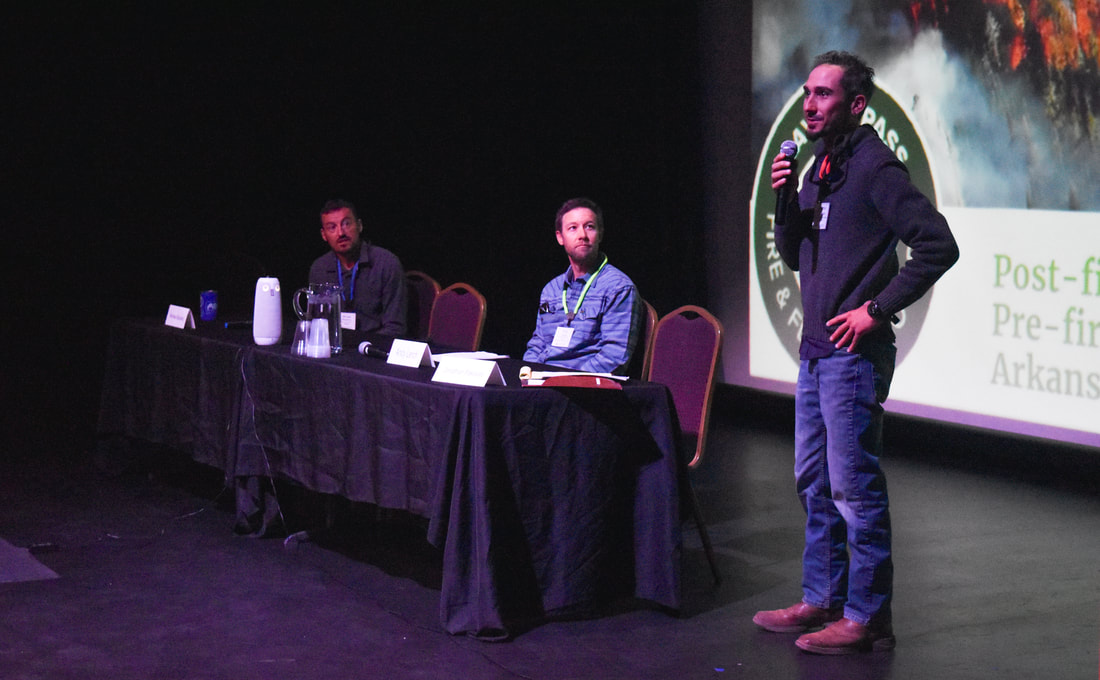
 ARWC Executive Director Jonathan Paklaian leads a session about wildfire mitigation and restoration at the 2022 Arkansas River Basin Water Forum in Salida. The Arkansas River Watershed Collaborative took center stage Friday at the Arkansas River Basin Water Forum during a panel discussion titled Wildfire Mitigation and Restoration in the Arkansas River Basin. ARWC Executive Director Jonathan Paklaian moderated the discussion, and Lead Forester Andy Lerch delivered a presentation about ARWC's work to support Ark Basin communities through projects addressing watershed issues like forest health, post-wildfire recovery and post-fire water quality. 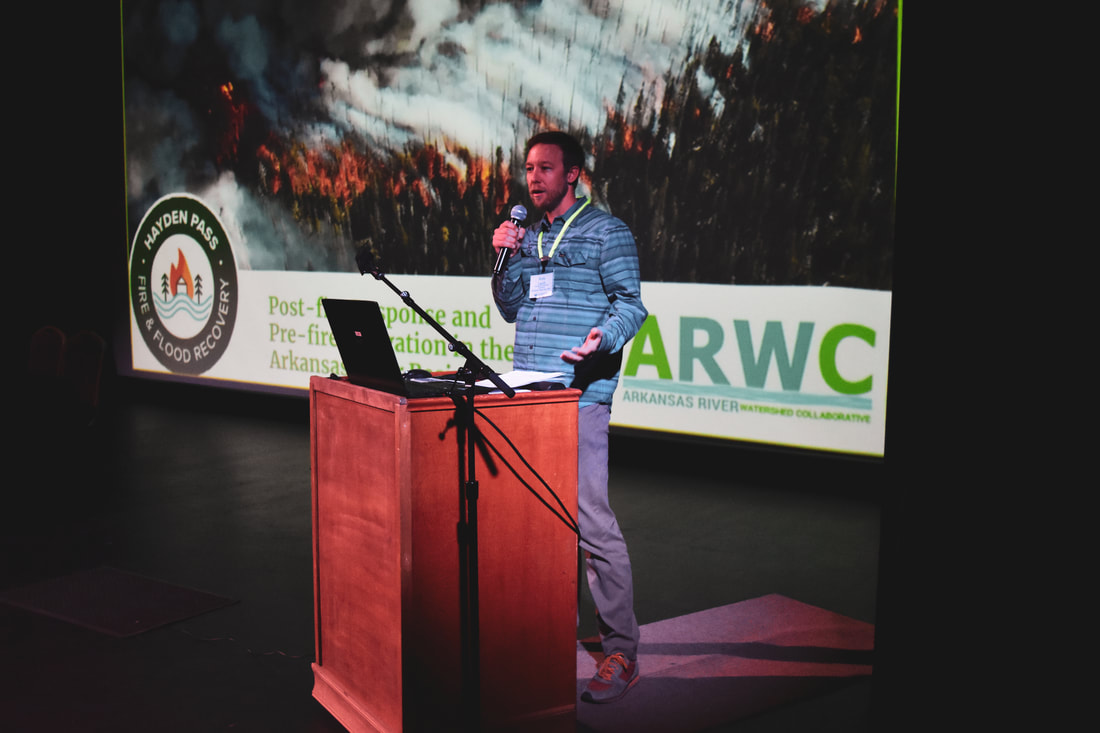 ARWC Lead Forester Andy Lerch speaks about the goals and accomplishments of the Monarch Pass Forest and Watershed Health Project.
0 Comments
The Arkansas River Basin Water Forum is now accepting session proposals for the Forum to be held at the Salida Steam Plant on April 28 and 29, 2022. Sessions are 60 or 90 minutes, depending upon the content. The theme of this year’s Water Forum has yet to be developed.
Please send session proposals to the Arkansas River Basin Water Forum no later than January 14, 2022, via email to arbwf1994@gmail.com. No late submissions will be accepted. The planning committee will review all proposals and make selections by January 24, 2022.  Fishers Peak, the centerpiece of one of Colorado's newest state parks. Fishers Peak, the iconic butte overlooking Trinidad is now protected as one of Colorado’s newest state parks. Colorado Parks and Wildlife and the Fishers Peak State Park Planning Team are engaging stakeholders as part of the master planning process for the new park. ARWC Executive Director Jonathan Paklaian attended a recent stakeholder meeting to review proposed plans and take a tour of the park. In addition to the flat-topped mountain, Fishers Peak State Park encompasses 19,200 acres of land known to locals as Crazy French Ranch. The Trinidad City Council approved the purchase of 4,000 acres of the ranch as a city park and began working with The Nature Conservancy and The Trust for Public Land. With the two national nonprofits on board, the effort expanded and received additional funding from Great Outdoors Colorado, Colorado Parks and Wildlife and the National Fish and Wildlife Foundation. CPW monies came from its Habitat Stamp funds. The new state park includes pristine oak and pine forests, volcanic cliffs and grasslands surrounding Fishers Peak, which dominates the view from Trinidad. ARWC is engaged in the master planning effort as protecting this natural landscape protects headwaters tributaries of the Purgatoire River in the southern Arkansas River Basin. The Master Plan for the park will include various recreational elements as well as preservation of natural ecosystems and landscapes. More information about the park and the draft Master Plan can be found here.  Stakeholders get a tour of the new Fishers Peak State Park near Trinidad.
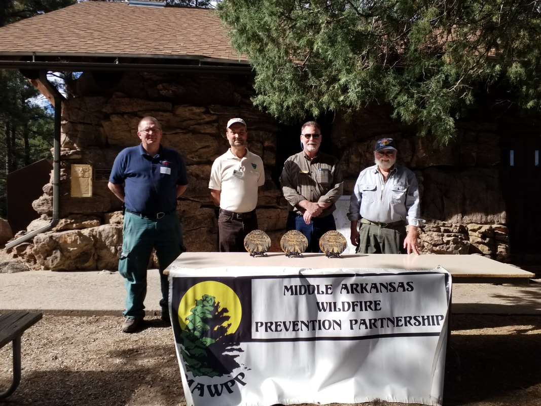 From left: Dennis Page, U.S. Forest Service Fire Management Division 3 Chief, San Carlos Ranger District; Ed Skerjanec, BLM Fire Mitigation Specialist; John Grieve, Colorado State Forest Service Supervisory Forester of Forest Planning and Implementation; and Steve Douglas, firefighter and Ember Alliance member. For more than a decade, the Middle Arkansas Wildfire Prevention Partnership (MAWPP) has worked at the forefront of wildfire mitigation in Fremont, Custer, and Pueblo counties through a collaborative effort among multiple agencies, including the U.S. Forest Service, the Bureau of Land Management, the Colorado State Forest Service, and local entities and individuals, including firefighters.
As part of a decision to disband, the Partnership’s board of directors decided to transfer to ARWC their remaining assets to support ongoing fire mitigation efforts. During a ceremony at Pueblo Mountain Park, MAWPP board members Amy Daniels and Todd Bell, and long-standing member Steve Douglas, were honored for their dedication to the Partnership’s mission. They volunteered countless hours working to promote fire mitigation throughout the Wet Mountain region at multiple meetings and events in area communities and organized drop-off days at the slash site on Highway 78, aka 12-Mile Road. To fill the gap left by MAWPP, ARWC has formed a mitigation group in the Middle Ark Basin area to collaborate on fire mitigation and prevention projects. ARWC has also taken over management of the slash site and will continue to organize approximately three drop-off days per year. This continued management includes informing residents about the opportunity to drop off slash to be burned by the U.S. Forest Service personnel. We are incredibly grateful for all the wildfire mitigation and education work accomplished by MAWPP, and we are honored that they have entrusted us to carry their efforts forward at a time when the risk of catastrophic wildfire continues to grow.  Follow Scott's Blog on the Monarch Mountain website for info about snowpack, weather, ski conditions and more.
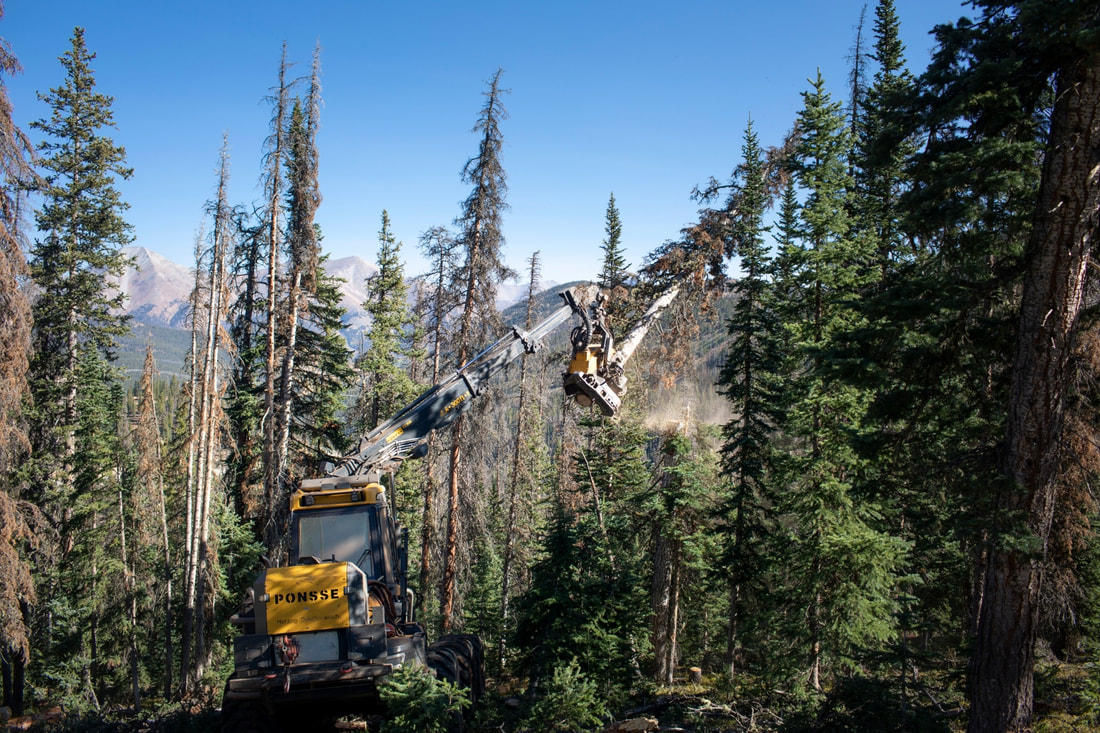  Photo: Fire Adapted Communities Learning Network. Thanks to the fuels treatments done by the Colorado State Forest Service and partners, fire response crews were able to contain the Golf Course Fire before it entered nearby communities. Read more about how wildfire mitigation works here. MAY 22, 2021
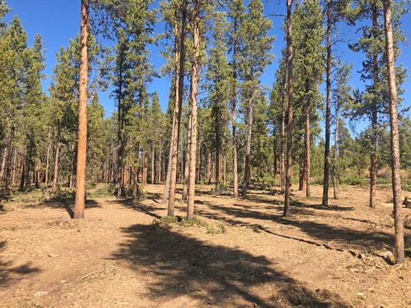
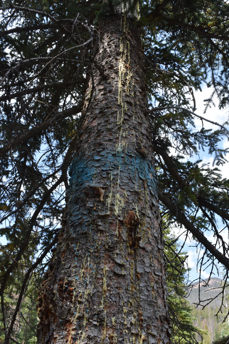
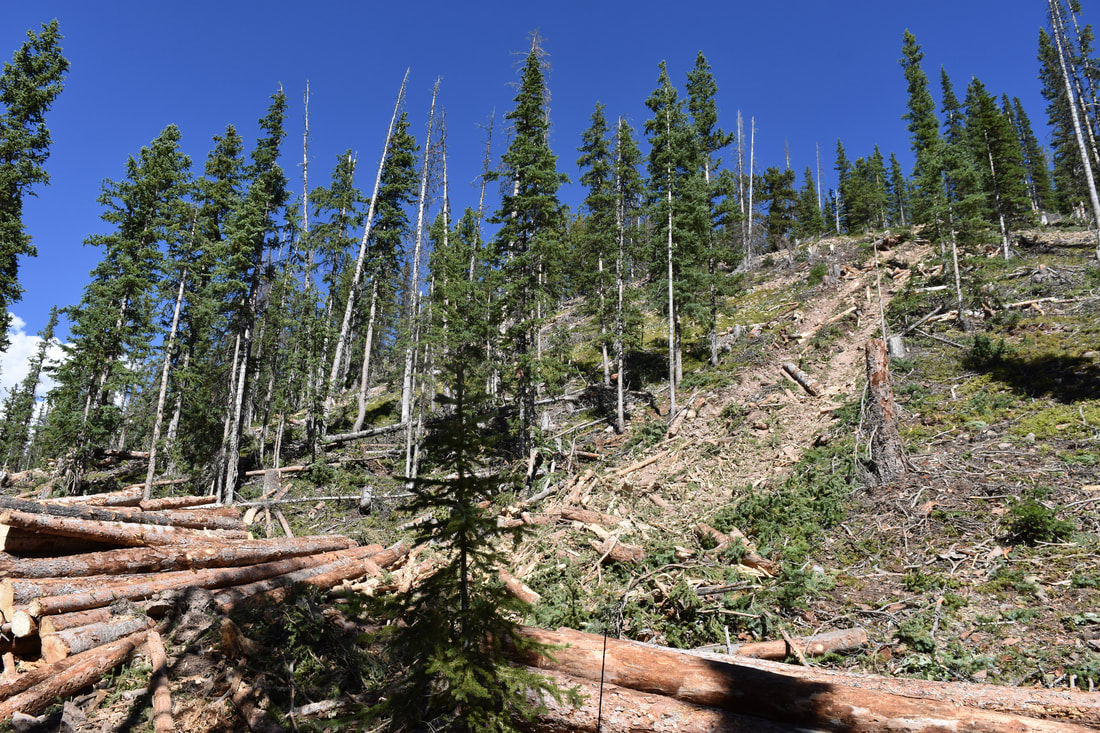
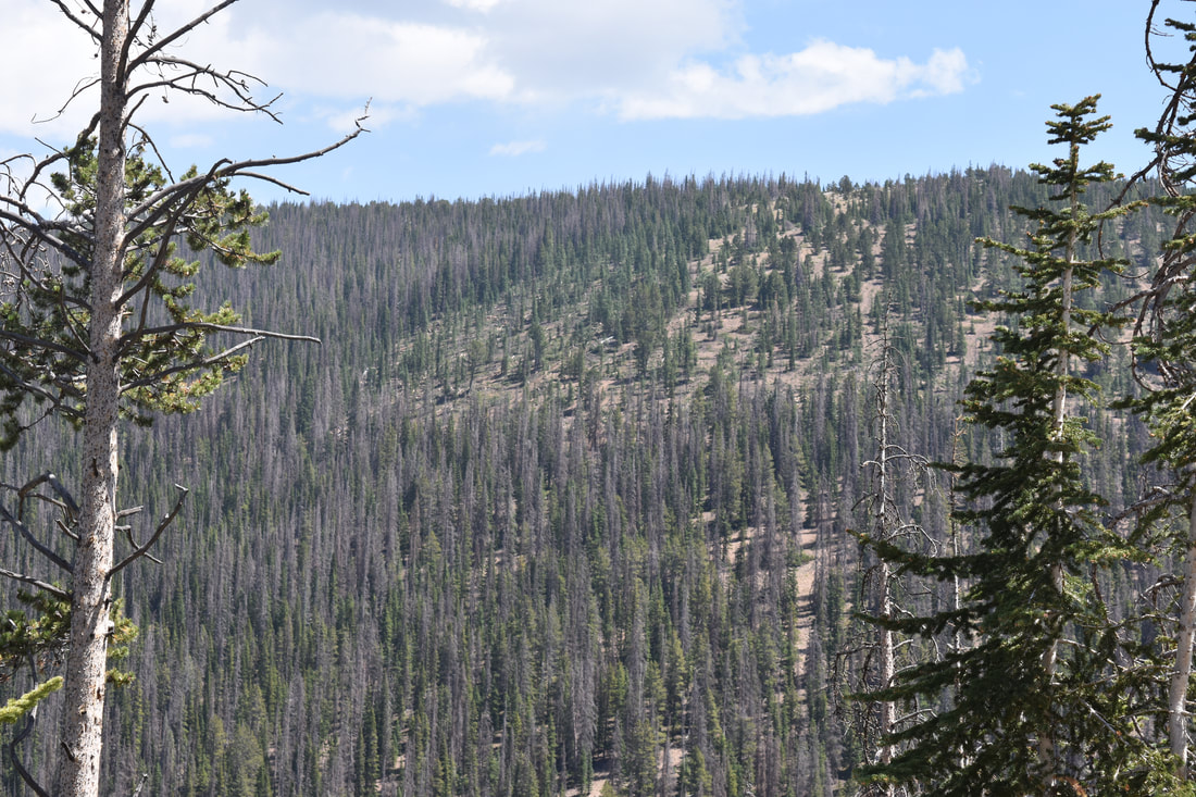
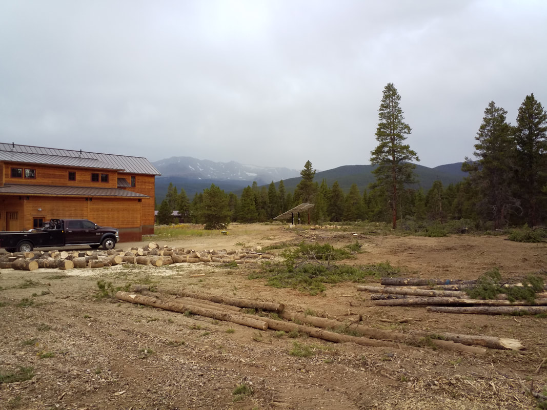
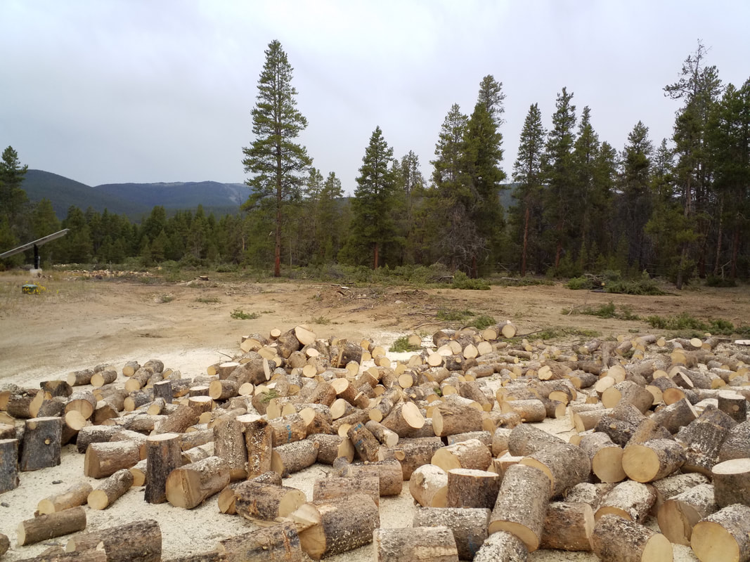
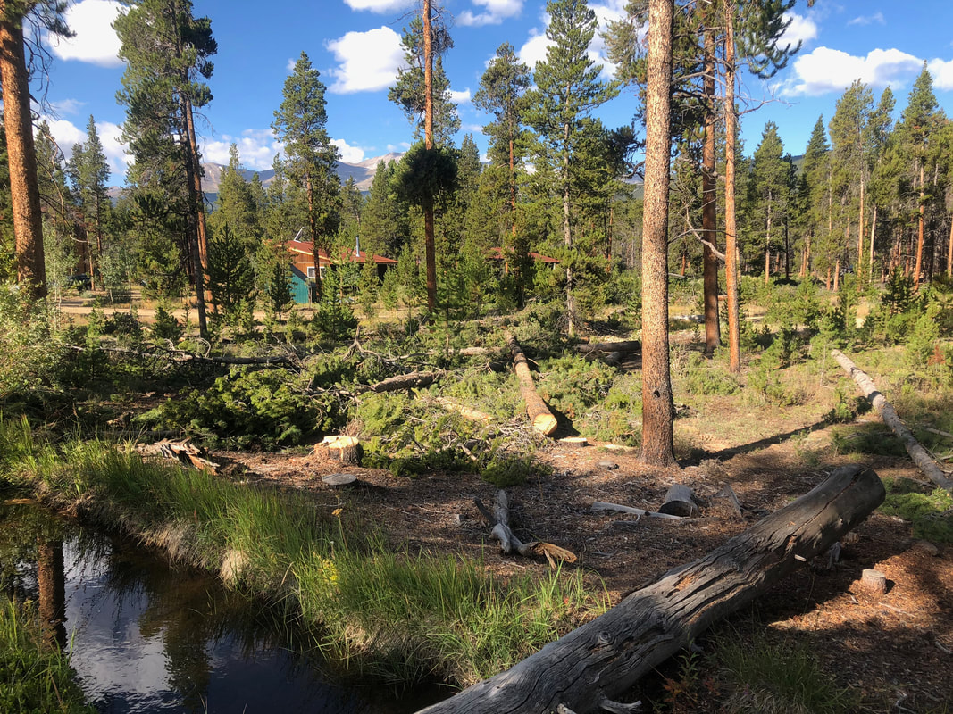
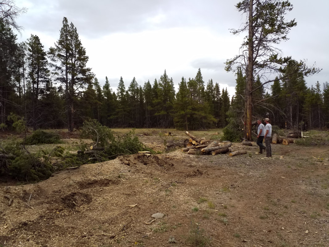
JUNE 26, 2021 SEPTEMBER 11, 2021 8AM-4PM Highway 78 Mile 1.0 (commonly called 12-Mile Road) To reduce wildfire hazard in our communities, the US Forest Service, San Carlos Ranger District and ARWC will host wildfire mitigation slash collection sites. Residents are invited to bring slash and natural woody material from wildfire mitigation efforts to the staffed collection site during these one-day events. Only slash and natural woody material from wildfire mitigation efforts is accepted. Absolutely no trash. Each load will be evaluated before unloading. Please help us continue this service to the community by honoring these rules: Bring only natural woody debris from wildfire mitigation efforts on your property. Limbs and branches from firs, pines, oak and brush will be accepted. NO lumber, weeds, grass, sawdust, stumps, wood chips or trash of any kind will be allowed. NO ground litter such as mulch or pine needles will be allowed. NO commercial operators at this event. Contractors working for participating landowners are welcome. USFS will collect the slash piles for burning next winter. Additional collection dates will be offered throughout the year. We will post that information here. For more information, please contact Allyson Pokrzywinski @ allyson.pokrzywinski@usda.gov or 719 221 5215. 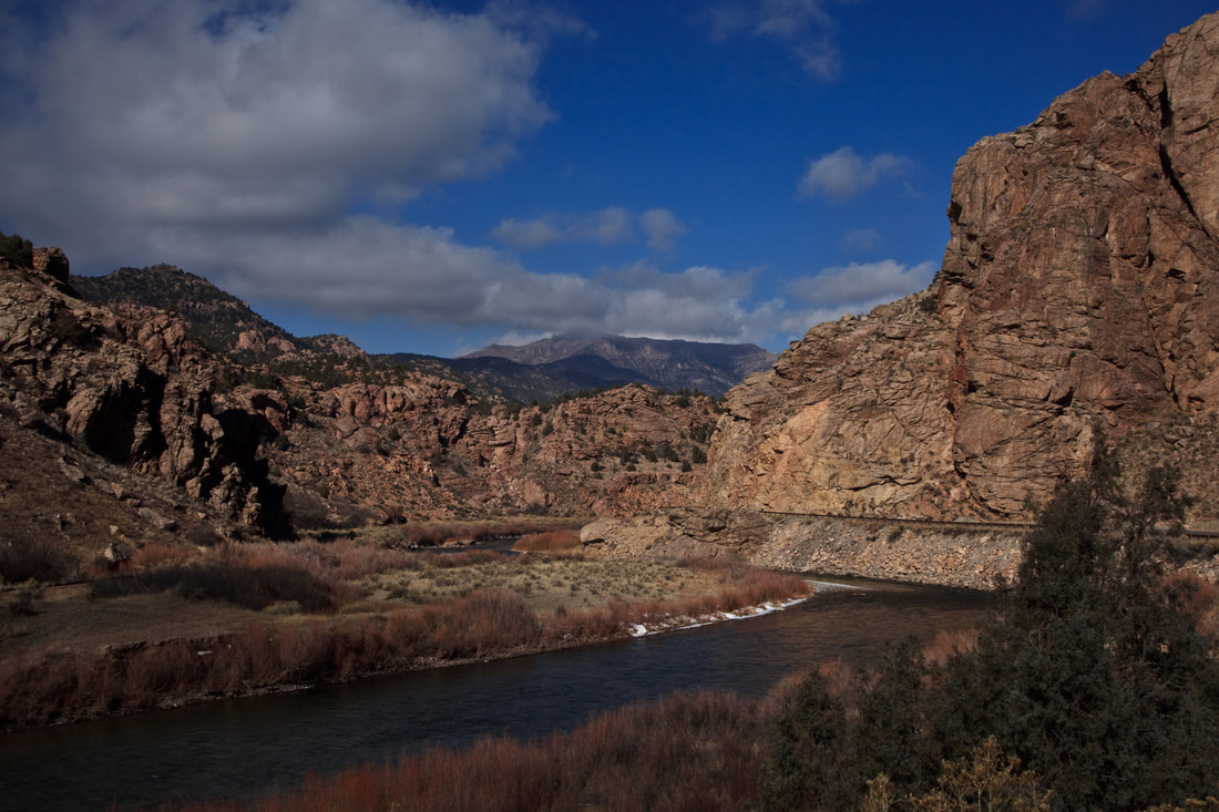 Arkansas River in Bighorn Sheep Canyon. Photo: ARWC OVERVIEW ARWC secures funding, develops partnerships and implements projects to help meet critical needs within the watersheds of the Arkansas River Basin. In 2020 and 2021, our work centered on forest health, wildfire mitigation and post-wildfire recovery. We are working to improve forest health conditions and reduce the risk of catastrophic wildfire through fuels mitigation and education. We are implementing on-the-ground fuels reduction projects in Chaffee and Lake Counties and planning for this work with partners and communities in the central basin. We have been helping communities affected by the Hayden Pass Fire, Decker Fire and Spring Fire respond quickly following wildfire to prepare for post-wildfire flooding that can threaten life, safety and critical infrastructure. We continue to assist communities as they plan for long-term recovery of land, water and wildlife. We are sharing the unique challenges to emergency response and recovery with policymakers and other communities to help make resources and response more effective for other communities facing the aftermath of wildfire. FOREST HEALTH, EDUCATION AND OUTREACH Monarch Pass Forest and Watershed Health Project 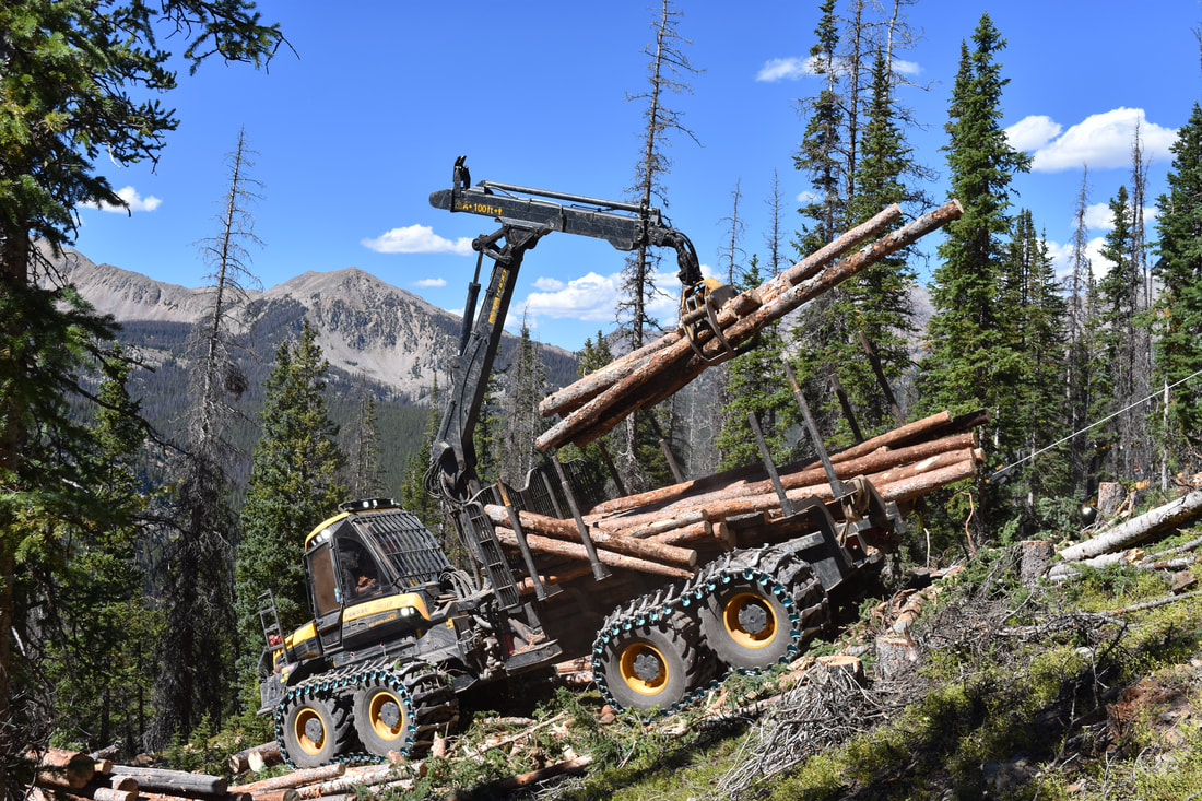 The Monarch Pass Forest and Watershed Health Project introduces new technology and equipment to Colorado that can safely and effectively remove beetle-killed trees from steep slopes while reducing cost and minimizing environmental disturbance. Photos: ARWC/Andy Lerch ARWC and its partners completed the first successful season of fuels mitigation and forest stand improvement in the headwaters of the South Arkansas River near Monarch Pass. This project is the first steep-slope forest stewardship project with cut-to-length technology performed in Colorado and is enabling treatment of steep areas of poor forest health that was impossible. Work reduces the risk of high severity fire in a large portion of the South Arkansas River headwaters. Treatment includes 183 acres completed in 2020, 158 acres to be completed in 2021, with an additional proposed 125 acres in 2021 if funded. Work complements treatments done by Monarch Ski Area and creates a larger, landscape-scale project with greater reach for the watershed and users. Outreach and education to the community includes tours of project areas and educational signs and a video for display at Monarch Ski Area. Lake County Wildfire Mitigation Fuels reduction and forest stand improvement at High Mountain Institute in Leadville. Photos: Andy Lerch/ARWC In 2019, ARWC began the process of implementing forest health and wildfire mitigation projects and related education and outreach and key locations in the area. ARWC completed chipping projects with Friends of Twin Lakes and Beaver Lakes Estates in 2019, allowing landowners to dispose of trees and wood leftover from mitigation efforts on their properties. Additional chipper days being scheduled with other communities. We completed a fuels mitigation and forest stand improvement project with High Mountain Institute near Leadville. Learn more about the project here. We continue to engage with our Lake County neighbors as we participate in the local Community Wildfire Protection Plan development. We are developing projects and seeking funds for mitigation in other neighborhood near Leadville and collaborating with CSU and the USFS to prioritize additional treatment areas within the upper parts of the Arkansas River Basin. Central Basin Wildfire Mitigation Planning ARWC is building relationships with landowners and partners in the central basin to better understand the forest health and wildfire mitigation needs in these areas. Working in partnership with the USFS, we are forming a stakeholder group to better focus ARWC’s mitigation work in the currently underserved central basin. We are developing forest health and mitigation projects for Camp Jackson on Highway 165 and the surrounding USFS area. We will run a slash site 3 times in 2021 at the USFS 12-Mile Gravel Pit on Highway 78 between Pueblo and Beulah to allow landowners to dispose of woody material from their own thinning work. We are developing funding for roadside treatments in the upper reaches of the Cucharas and Purgatoire watersheds. As we grow as an organization and have additional capacity of staff and funding, we will continue to expand our work into more of the basin. POST-WILDFIRE RECOVERY Hayden Pass Fire Recovery Fremont County, Colorado 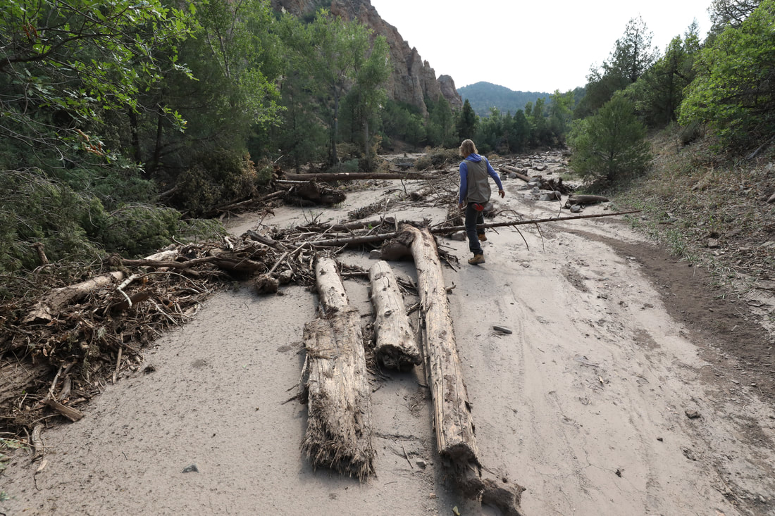 Flooding damage in the Hayden Pass Fire area. Photo: ARWC With natural and project-supported recovery taking hold in the Hayden Pass area, ARWC continues to plan for long-term recovery in the Hayden Pass area. We completed a rural fire recovery case study to share lessons learned from the recovery process in this community to advocate for changes in emergency funding programs and help other communities plan for post-wildfire conditions. We are creating a long-term master recovery plan in partnership with River Science to guide the community through prioritization and implementation of restoration activities that reduce flood hazards and improve ecological conditions within the flood-impacted channel systems. The plan lays out designs, cost estimates and implementation guidance for work to meet a wide range of objectives that support long-term recovery after the most devastating post-fire floods. The plan describes a comprehensive approach to help mitigate damage from potential future floods, support recreational and economic opportunities within the watershed and encourage healthy riparian habitat for fish, wildlife and native plant communities. Decker Fire Recovery Chaffee County, Colorado  Decker Fire burned near Salida in 2019. Photo: ARWC 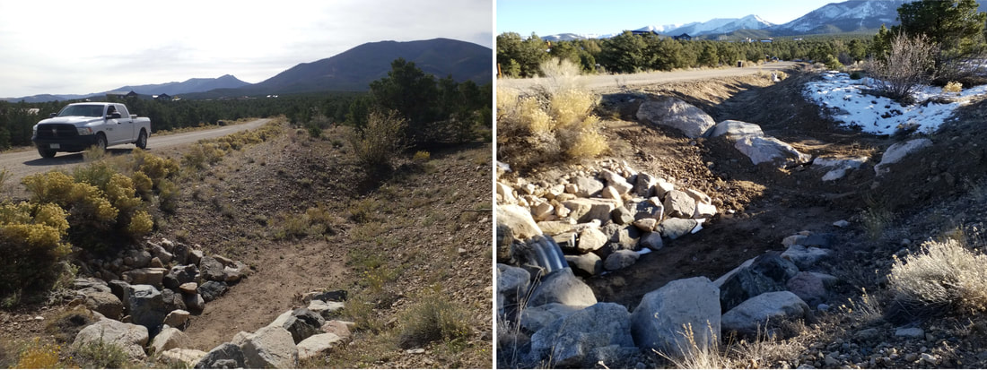 Bar ditch improvement in Loggie Gulch. Photo: ARWC With funding from the Colorado Department of Public Health and Environment (CDPHE), ARWC collaborated with Chaffee County and residents impacted by the Decker Fire - and subsequent flooding - to address issues most likely to negatively impact life, safety, property, recreation, and the delicate ecological systems of the Arkansas River watershed. Projects were designed to protect life and safety, provide education and reduce the potential for non-point source pollution that impacts water quality by improving post-fire areas to reduce sediment and contaminant delivery into the Arkansas River. ARWC increased the capacity of a stormwater drainage system bar ditch below the burn scar to accomodate heavier storm flows. The work allows the structure to hold more sediment and help prevent property damage below the structure. We reinforced a stock pond full of water and sediment at risk of breaching, and re-contoured and reinforced an emergency spillway. We used log structures to protect the channel and encourage the water to spread out and deposit sediment in a field. ARWC worked in partnership with River Science, Canon City Water, and Colorado Springs Utilities to install two turbidity sensors between Canon City and Salida to allow the water providers enough time to react to precipitation and sediment runoff from post-fire areas that threaten drinking water supplies and infrastructure. We are thankful for the opportunity to partner with CDPHE and aid those who are affected by the Decker Fire. Although this funding provided some relief to address the most pressing issues that could impact life, property, recreation, and the environment, we know that it cannot solve all the existing problems. Therefore, we provided education and outreach as part of our activities to inform landowners, partners, recreators, and downstream users of the potential risks and threats due to post-fire flooding. We hope to encourage individuals to act independently to protect their properties and inspire other federal, state, and local partners to join us in the recovery and protection of our watershed. Our outreach included educating landowners about how to handle ash, debris removal, water rights, and educating the county on EWP procedures, identifying areas of concern. Spring Fire Recovery Huerfano County, Colorado ARWC is working with communities impacted by the 2018 Spring Fire and post-fire flooding to mitigate threats to life, safety and infrastructure and help encourage long-term recovery of the land. Our work is funded by the Colorado Department of Public Health and Environment and the Colorado Water Conservation Board, in partnership with Huerfano County Water Conservancy District. Funding allowed us to work with an engineer to develop fluvial hazard maps and refined hydraulic models for Middle, Indian, and South Abeyta Creeks to use for damage estimates and project prioritization. These tools identify sites likely to be impacted by sediment and debris transport during post-fire flood events in the burn area, allowing us to plan for the most needed projects for the greatest positive impact on the ground. ARWC worked with the locals to dig out an old swimming pool along Indian Creek to repurpose this unused pool as a sediment trap to protect people, working lands, and infrastructure below. In late 2020, we worked at 11 sites and applied hydroseed to 13 acres to encourage regrowth of vegetation to hold soils and improve wildlife habitat. We worked on repairing erosion and damage along agricultural ditches, cleared channels at multiple sites and installed structures to protect critical roadways. We installed log structures along multiple drainages in the burn area to slow water and sediment, reducing damage below and holding soils and moisture to encourage long-term recovery of the land. POST-WILDFIRE WATER QUALITY MONITORING 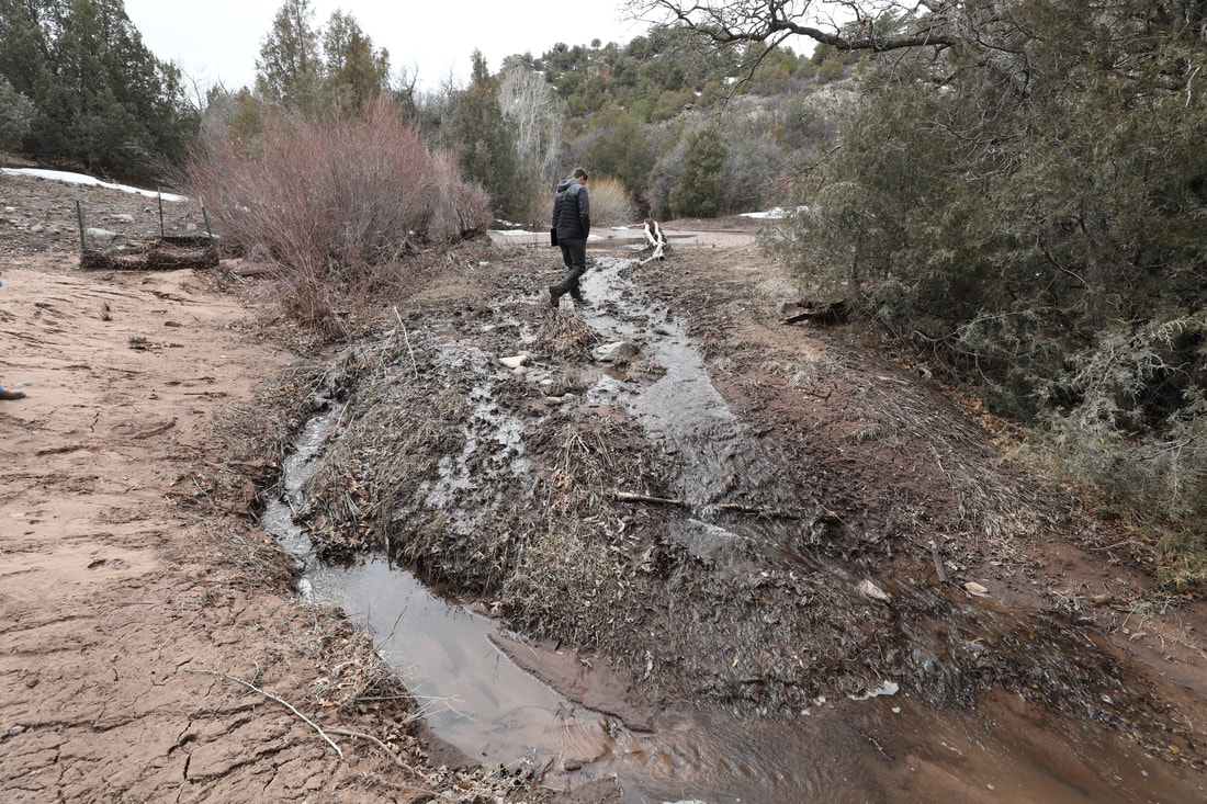 Luke Javernick of River Science assesses a flooded area in the Hayden Pass Fire area. Increased sedimentation and runoff from burn scars can negatively impact drinking water supplies and infrastructure. Photo: ARWC Precipitation runoff from post-fire areas threatens drinking water supplies and infrastructure. Canon City, Pueblo and Colorado Springs drinking water supplies are impacted by runoff from the Decker and Hayden Pass Fires.
Downstream of the fire, Canon City feeds its water treatment reservoir directly from the Arkansas River. Since the Hayden Pass Fire, the Western Fremont Fire Protection District has monitored river conditions and warned Canon City Water Dept. officials of highly concentrated suspended sediment in storm-flow runoff from the burn scar. Thanks to warnings from Western Fremont firefighters, Canon City Water is able to close the river intakes until water quality improves, thereby safeguarding Canon City water quality and protecting the city's vital water infrastructure. Colorado Springs Utilities pumps up to 50 million gallons a day from the Pueblo Reservoir. Given the critical supply of water and millions of dollars in infrastructure, monitoring water quality near the source could greatly safeguard these infrastructures and necessary water supplies. ARWC's partner River Science developed mutli-parameter water quality instruments that provide real time data alerts so that water providers downstream can take action when water conditions change due to large amounts of sediment and debris entering the system during a flood. 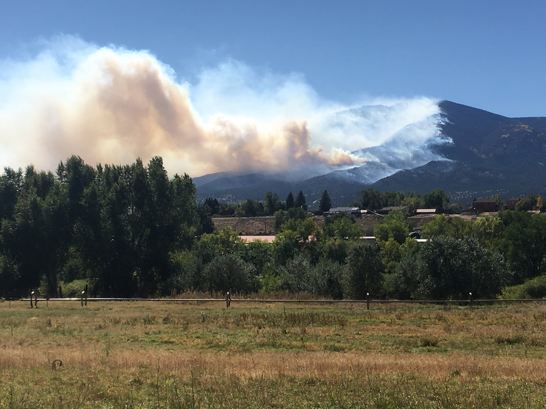 With funding from the Colorado Department of Public Health and Environment (CDPHE), ARWC collaborated with Chaffee County and residents impacted by the Decker Fire - and subsequent flooding - to address issues most likely to negatively impact life, safety, property, recreation, and the delicate ecological systems of the Arkansas River watershed. Projects were designed to protect life and safety, provide education and reduce the potential for non-point source pollution that impacts water quality by improving post-fire areas to reduce sediment and contaminant delivery into the Arkansas River. 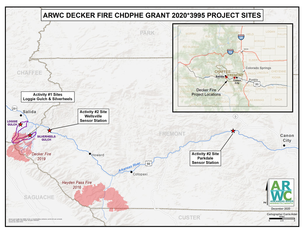 Bar ditch improvement in Loggie Gulch ARWC increased the capacity of a stormwater drainage system bar ditch below the burn scar to accomodate heavier storm flows. The work allows the structure to hold more sediment and help prevent property damage below the structure.
We reinforced a stock pond full of water and sediment at risk of breaching, and re-contoured and reinforced an emergency spillway. We used log structures to protect the channel and encourage the water to spread out and deposit sediment in a field. ARWC worked in partnership with River Science, Canon City Water, and Colorado Springs Utilities to install two turbidity sensors between Canon City and Salida to allow the water providers enough time to react to precipitation and sediment runoff from post-fire areas that threaten drinking water supplies and infrastructure. We are thankful for the opportunity to partner with CDPHE and aid those who are affected by the Decker Fire. Although this funding provided some relief to address the most pressing issues that could impact life, property, recreation, and the environment, we know that it cannot solve all the existing problems. Therefore, we provided education and outreach as part of our activities to inform landowners, partners, recreators, and downstream users of the potential risks and threats due to post-fire flooding. We hope to encourage individuals to act independently to protect their properties and inspire other federal, state, and local partners to join us in the recovery and protection of our watershed. Our outreach included educating landowners about how to handle ash, debris removal, water rights, and educating the county on EWP procedures, identifying areas of concern. |
ARCHIVES
September 2023
CATEGORIES
All
|

 RSS Feed
