
Much of the forest on the eastern slope of the Sangre de Cristo range is overstocked with dead and dying trees, an overload of understory wood and sparse healthy ground vegetation. The Hayden Pass fire burned - much of intensely - over nearly 16,700 acres of rugged terrain in multiple watersheds above the communities of Coaldale and Cotopaxi, leaving expanses with no vegetation to absorb rainfall. When it rains on these types of burned areas, the water rolls off scorched soils, carrying burned trees, top soil, rocks and other material down steep grades in post-fire floods which can threaten life, safety, property and infrastructure. Intensely burned areas are slow to regenerate, making recovery difficult for landowners, communities, agricultural and recreational interests, and wildlife habitat.
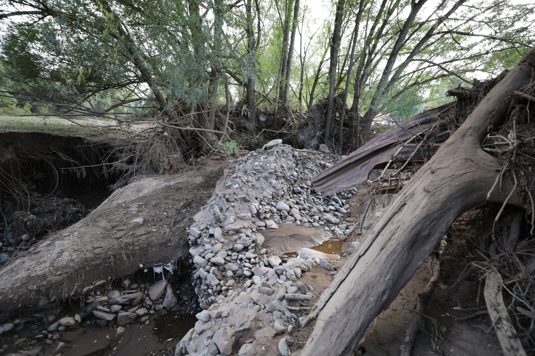
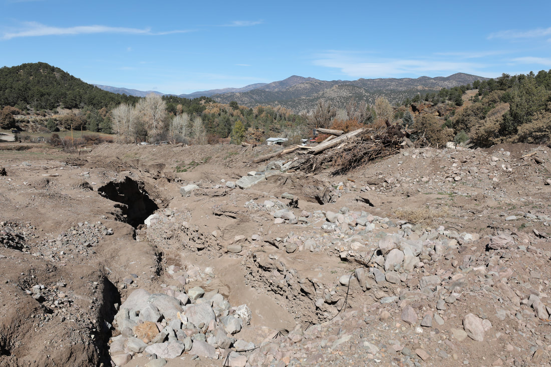
In the months following the fire, monsoonal storms brought the first flash floods and debris flows to the burn scar area. Ash flushed into the Arkansas River from Hayden and Big Cottonwood Creek watersheds, and generated large debris dams in the upper reaches of those drainages located primarily in USFS Wilderness Area. Storms continued this process on the burn in 2017 and 2018, with the most significant damage to date occurring on July 24, 2018. During a heavy burst over the top of the Big Cottonwood drainage, an estimated 4000 cfs flow generated flooding that destroyed and damaged homes, outbuildings, vehicles, bridges, and required a helicopter rescue.
Local response and timely intervention can help mitigate some of fire's negative impacts on communities and the landscape and help speed healing of both. Resources are often available after a fire from federal, state and county governments and nonprofit watershed health organizations. In some cases, recovery resources are slow to obtain, have implementation challenges and cannot meet all needs. In all cases, recovery efforts are most successful when the local community is organized and involved in recovery decisions from the start. Communities with organizations committed to watershed and forest health that are active prior to the fire are best equipped to respond to wildfire, flooding and other watershed concerns. Most small, rural communities do not have these types of organizations in place, but understand the needs of their communities and the lay of the land the best. ARWC was created to help support communities and respond - with the community - to watershed concerns, like wildfire, in the Arkansas River Basin.
Wildfire, and subsequent flooding, is traumatic for the communities facing it. Threats to safety, loss of life, as well as economic and ecological damage are major negative impacts of wildfire and post-fire conditions. Safety is of utmost importance during the fire and when post-fire flooding hits, which can be immediately following a fire during the first rain and remain a threat for many years. Education, awareness and preparedness is the best line of defense.
REPORTS
|
|
LOCAL CONTACTS
WESTERN FREMONT COUNTY FIRE PROTECTION DISTRICT
John Walker, Chief
719 942 3333
719 942 3687
13607 CR 45 Coaldale
FREMONT COUNTY EMERGENCY MANAGEMENT
Alert Fremont/911 Emergency Notifications
Be sure your cell phones are registered for emergency alerts. Even if you've registered before, check to make sure your information is accurate and up to date.
https://www.fremontco.com/alert-fremont
Mykel Kroll, Emergency Manager
719 276 7422
[email protected]
Facebook
https://www.facebook.com/Fremont-County-Emergency-Management-392929138145266/
FREMONT COUNTY BUILDING DEPARTMENT FLOOD DAMAGE PREVENTION PERMITS
To protect the floodplain and neighbor safety, the County has regulations for working in floodplains. To learn more, please visit the Building Department website where you can find the codes, applications and other permitting information:
https://www.fremontco.com/building/building-department
Michael Cox, Building Official
719 276 7460
FEMA
Matt Buddie, FEMA Region VIII Floodplain Management/Community Resilience
303 235 4730
[email protected]
NATIONAL WEATHER SERVICE
Greg Heavener, Warning Coordination Meterologist
719 948 9429
[email protected]
John Walker, Chief
719 942 3333
719 942 3687
13607 CR 45 Coaldale
FREMONT COUNTY EMERGENCY MANAGEMENT
Alert Fremont/911 Emergency Notifications
Be sure your cell phones are registered for emergency alerts. Even if you've registered before, check to make sure your information is accurate and up to date.
https://www.fremontco.com/alert-fremont
Mykel Kroll, Emergency Manager
719 276 7422
[email protected]
https://www.facebook.com/Fremont-County-Emergency-Management-392929138145266/
FREMONT COUNTY BUILDING DEPARTMENT FLOOD DAMAGE PREVENTION PERMITS
To protect the floodplain and neighbor safety, the County has regulations for working in floodplains. To learn more, please visit the Building Department website where you can find the codes, applications and other permitting information:
https://www.fremontco.com/building/building-department
Michael Cox, Building Official
719 276 7460
FEMA
Matt Buddie, FEMA Region VIII Floodplain Management/Community Resilience
303 235 4730
[email protected]
NATIONAL WEATHER SERVICE
Greg Heavener, Warning Coordination Meterologist
719 948 9429
[email protected]
