
|
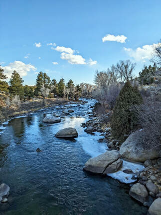
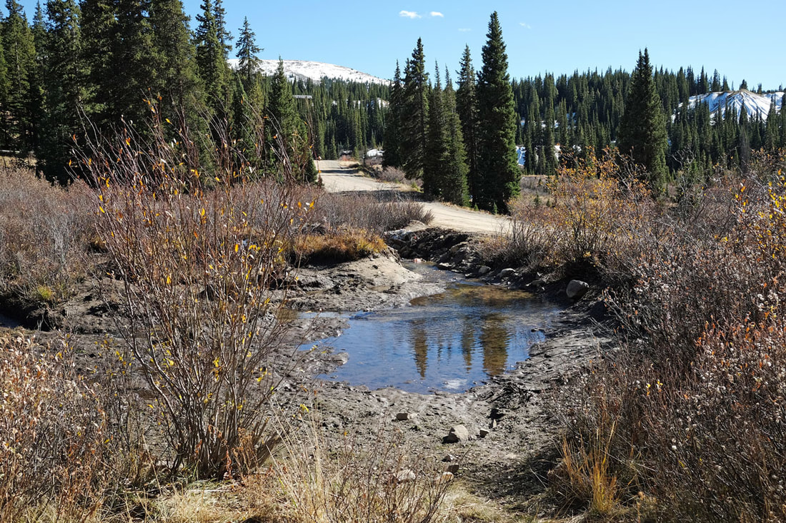
BRINGING BACK THE RIVERSRivers in their natural state are beautifully complex, featuring a mosaic of curves, depths, and textures, from rapid flows to gentle ripples, and from rocky beds to sandy banks. This complexity is essential, it boosts floodplain connectivity, fosters a rich diversity of life, stabilizes riverbanks, minimizes erosion, and mitigates flooding risks. |
PROJECT 1: ARKANSAS RIVER RESTORATION - EAST FORK
The Challenge:
A significant 2,000-foot stretch of the East Fork of the Arkansas River has been altered. Its once-winding meanders have been straightened, drastically simplifying its profile. Consequently, the river has split into two parallel paths: the original intricate channel and a newer, straightened channel that lacks the complexity of a sinuous channel and therefore is unable to support abundant aquatic life. Unfortunately, the straightened channel has become disconnected from its natural floodplain, compromising aquatic habitats and accelerating downcutting and lateral erosion.
Our Strategy:
Our mission is clear: guide the river back to its historical path. Through strategic earthworks and restoration activities, we'll coax the water to flow once more through its ancestral channel. We'll reinforce this channel with stabilization structures and introduce restoration treatments to foster the return of native species. Revitalizing this original channel will also breathe new life into neighboring wetlands and riparian zones.
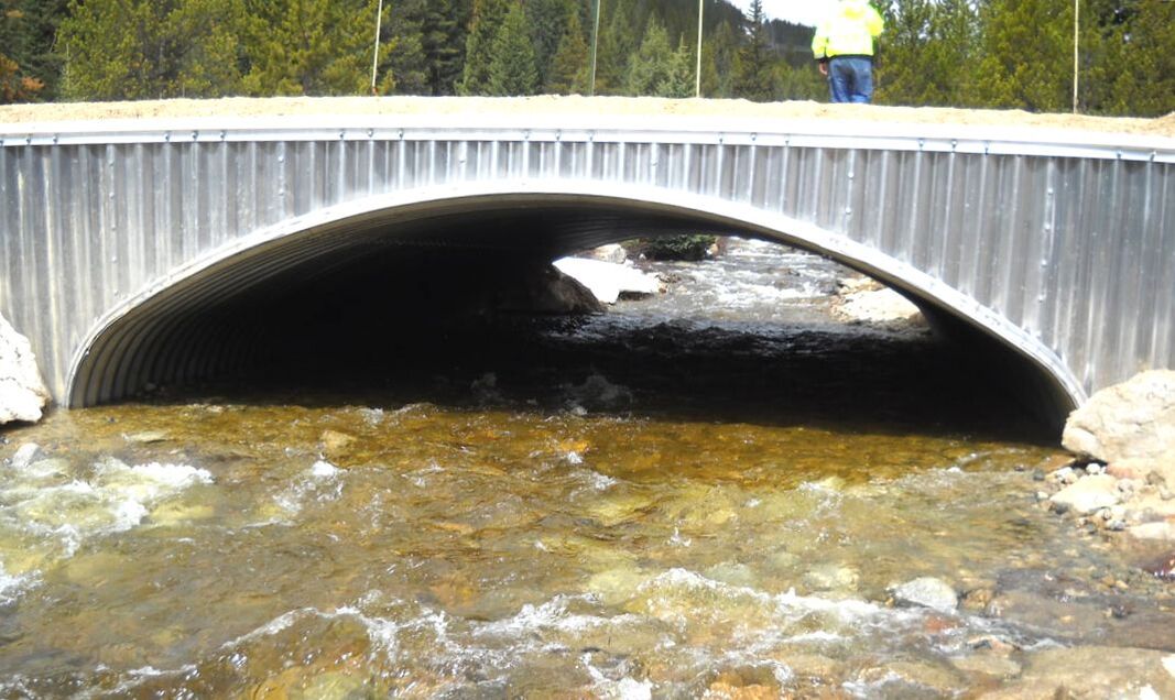
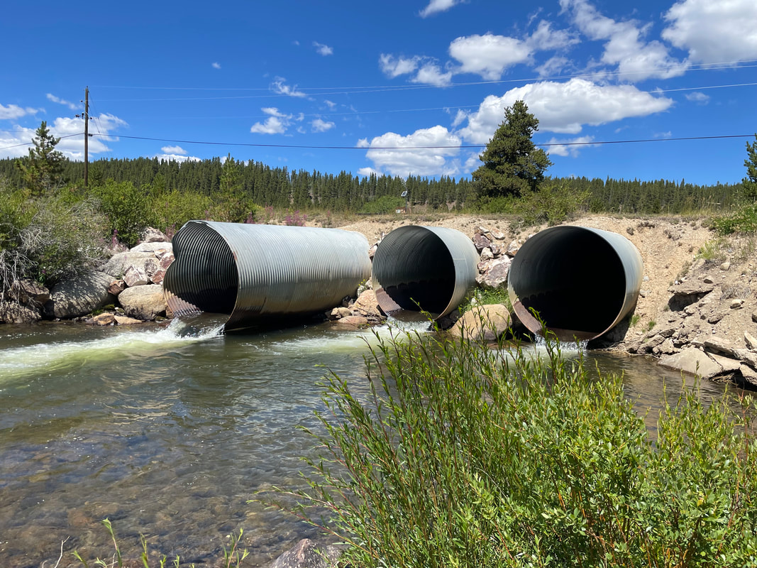
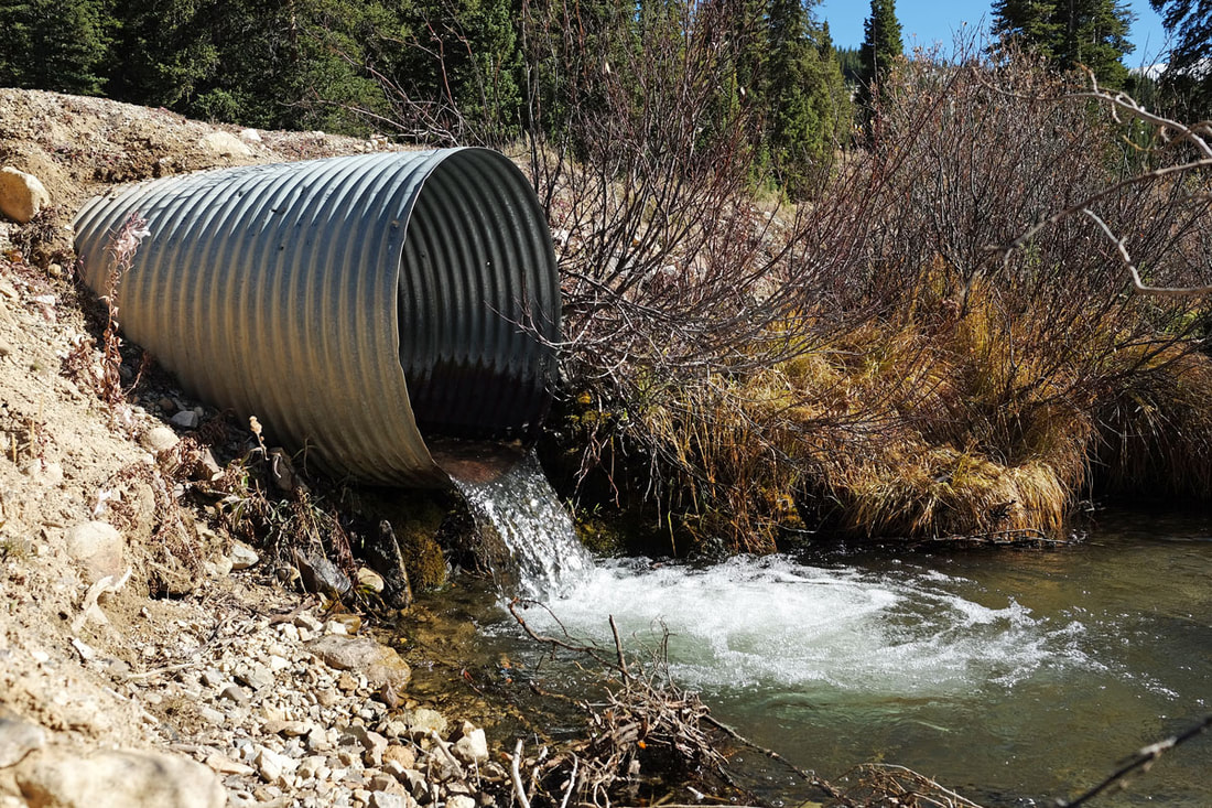
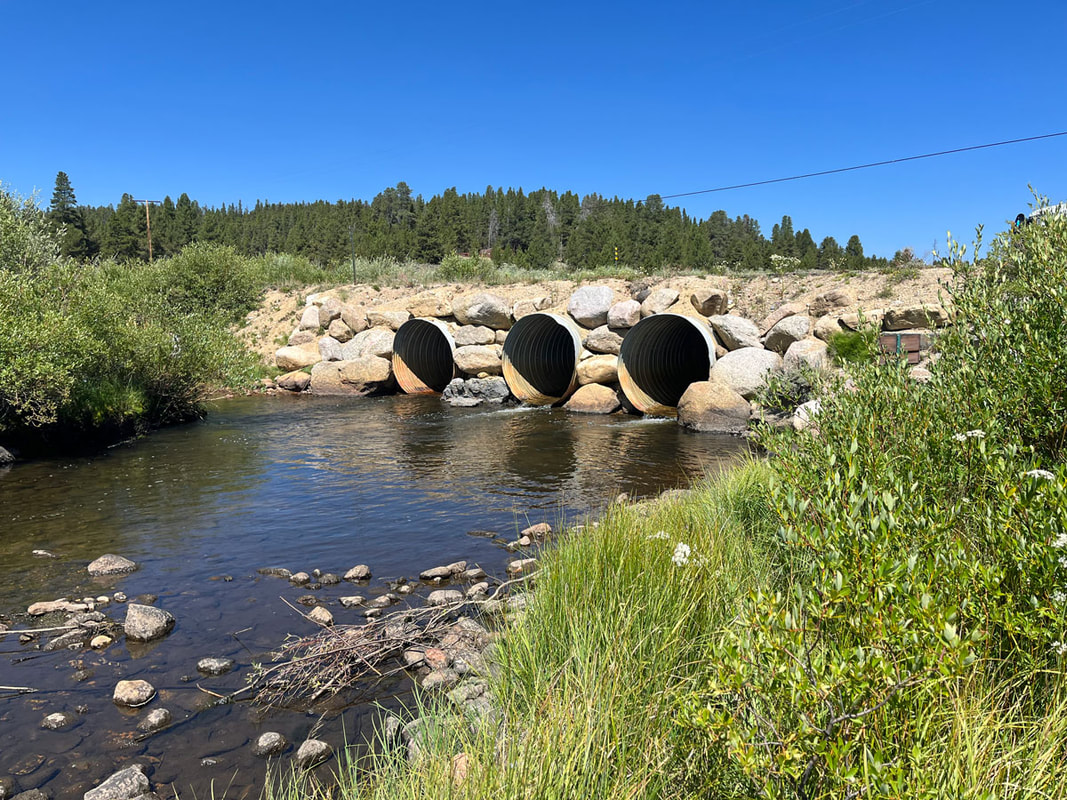
PROJECT 2: FROM NARROW CULVERTS TO RIVER-SPANNING BRIDGES
Replacing culverts with a more integrated bridge design offers environmental, economic, and social benefits
Ecological and Environmental Benefits:
- Bridges support a natural water flow, enhancing ecosystem connectivity and benefiting migrating aquatic species like fish.
- Unlike culverts, bridges allow water to flow more freely, preventing water constriction. A free flowing stream reduces erosion, preserves the stream’s natural environment, and allows debris to pass freely. This minimizes blockages and reduces the likelihood of flooding.
- Bridges, often equipped with pedestrian paths, open up recreational opportunities such as walking, biking, and fishing.
- Bridges provide better habitat for aquatic species, increasing the quality of fishing and other recreational opportunities along streams.
- Bridges offer a safer passage for both aquatic life and humans, with clearer visibility for drivers, reducing accident risks.
- Well-built bridges outlast culverts, demanding less maintenance and proving cost-effective over time.
- Bridges bolster community resilience by safeguarding against potential flood damage to roads and ensuring transportation infrastructure can withstand extreme weather events linked to climate change.
- Reduced maintenance needs means your local agencies can spend more time on other community projects.
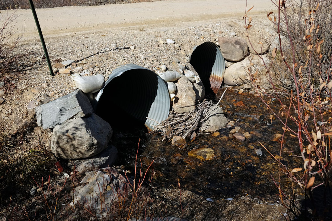
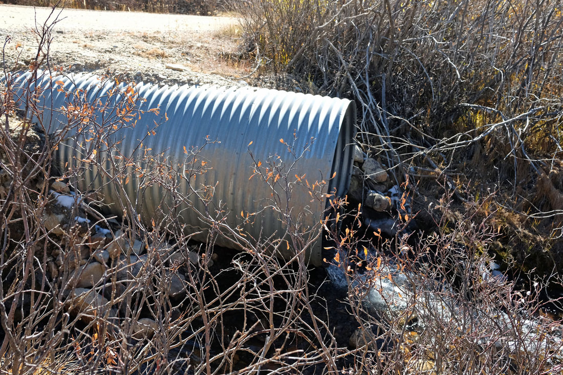
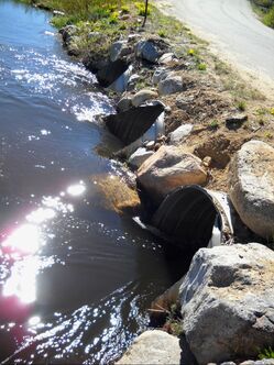
The Challenge:
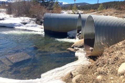
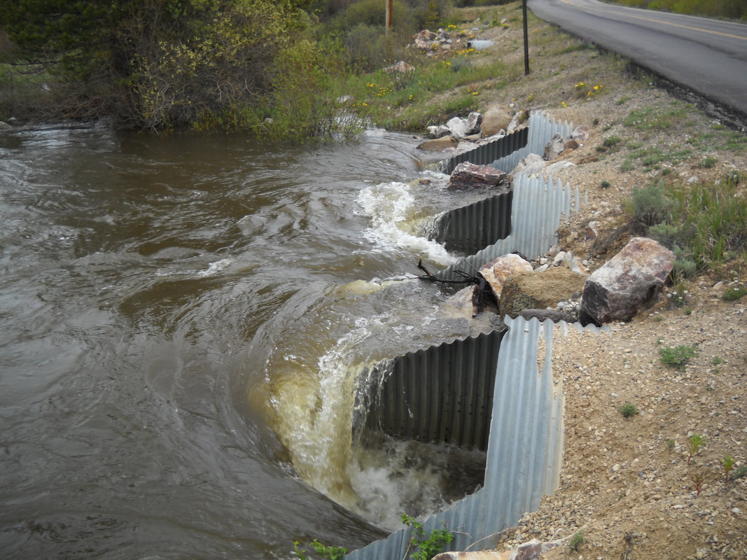
Historically, the delicate balance of streams and creeks was overlooked when roads were being constructed. The primary focus was on cost-efficiency and effective water management. As a result, construction teams typically opted for narrow culverts, designed to usher water beneath roads at a rapid pace. While this approach might have appeared efficient on paper, its real-world implications were far-reaching and often detrimental.
The rapid movement of water through these culverts has resulted in riverbank erosion and a disturbance to the stream's natural flow. Ultimately, this not only impacts the banks of the river, but also creates a challenging environment for aquatic life. Fish, integral to these ecosystems, can find it particularly difficult to navigate these modified waterways, often becoming trapped or injured.
Additionally, this design can result in a phenomenon known as "downstream scouring," where water rapidly exiting a culvert quickly erodes the downstream area. This rapid water movement creates a disconnect between the culvert's exit point and the natural downstream flow. The result? Instability in the banks both upstream and downstream, with both areas susceptible to erosion, collapse, and widening. The eroded sediment from these areas can flow downstream and deposit in inconvenient areas, further degrading the stream's natural state.
In order to keep water flowing, maintenance crews need to visit and clean these areas often. Crews attempt to remove accumulated debris and sediment in order to keep water flowing and reduce damage to the roadways. But with busy crews and hard-to-access areas, the sites become a challenge for residents, maintenance crews, and crucially, emergency responders during floods.
Our Strategy:
|
AWRC is partnering with Lake County and the US Forest Service to replace problematic culverts throughout Lake County. Over the next 5 years, 7 culverts are slated for replacement. Culverts will be replaced with environmentally-friendly designs that consider the needs of both the environment and aquatic life dependent upon local streams. We'll use structures like bottomless arches or large box culverts with special designs to aid fish passage and proper sediment transport. Additionally, we'll work on reducing erosion around these culverts by rehabilitating the surrounding habitats. |
|
The project areas selected have been impacted by previous mining damages and work in these areas is crucial for enhancing natural habitats and providing better public access, especially during emergencies. Our efforts will not only improve the environment and habitats for aquatic life but will also ensure the public has better access to these natural resources. Places like Evans Gulch, Lake Fork of the Arkansas, and Halfmoon Creek, which have faced environmental challenges due to past mining, have shown significant improvement thanks to past collaborative efforts. With the proposed culvert replacements, we aim to further improve these areas, ensuring that the public can fully enjoy and appreciate these beautiful and restorative spaces.
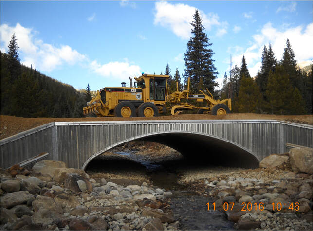
Here is an example of a bridge designed to offer environmental, economic, and social benefits! |
Project Details
Postponed until 2024
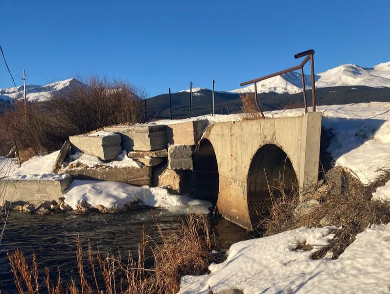
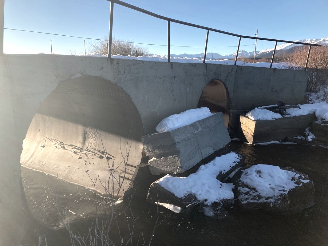
Lake County Road 11 at Lake Fork Creek
|
The culvert located at Lake County Road 11 at Lake Fork Creek is adjacent to past NRD Trustee investment and is the sole egress access road leading to critical natural resource sites up Halfmoon Creek and to Turquoise Lake. Replacement of the culvert will enhance habitat and provide passage and stability for access to other critical natural habitat and resources, especially in the event of an emergency response.
|
Replacement was scheduled for fall of 2023, but has been postponed until 2024. Please check back for updates. |
Before replacement:
|
|
2024
Halfmoon at Mount Massive Trailhead
The USFS is currently seeking public inout on the Halfmoon Project. View more info and submit your feedback HERE.
|
The current culvert at the Mount Massive Trailhead has caused the channel to over-widen at the outflow of the culvert. It prevents fish passage, limiting upstream migration to publicly accessible waters. Replacement of the culvert will improve stream health by creating a natural stream bottom, increasing floodplain connectivity, and allowing for aquatic organism passage.
|
The USFS has identified a more suitable location for placement of a stream crossing approximately 200 yards downstream of the current culvert. This project will install a box culvert in this new location, providing a better experience for the public traveling on the road and to the trailhead. The previous culvert location will be restored.
|
Before replacement:
|
|
Lake County Road 5A at Lake Fork Creek
|
The culvert at Lake County Road 5A and Lake Fork Creek provides the sole access leading to critical natural resource sites up Halfmoon Creek and Turquoise Lake. Lake Fork Creek is home to an important fishery and provides public access for fishing and other recreational opportunities. The current culvert restricts movement of aquatic life and limits public access to the waterway.
|
Replacement of the culvert will allow the passage of aquatic species up and down the stream and will create a more stable and resilient crossing for the public and emergency response services.
|
Before replacement:
|
|
2025
Lake County Road 4 at the Arkansas River
|
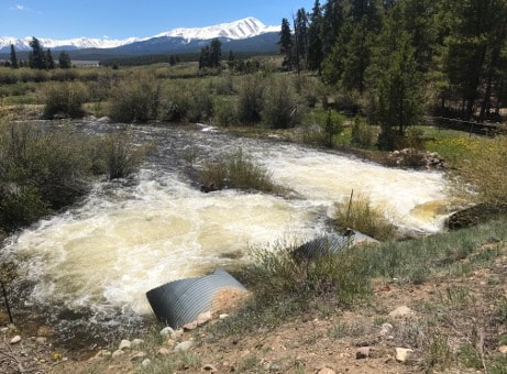
The culvert at Lake County Road 4 at the Arkansas River becomes blocked regularly, creating overflows, washouts, and inlet flooding. Additionally, low flow conditions at the culvert prevents aquatic passage.
|
Replacement of this culvert will improve stream health by creating a natural stream bottom, increasing floodplain connectivity, and allowing for aquatic organism passage. The replacement will also minimize potential debris blockage, simplifying maintenance on managers.
|
Before replacement:
|
|
2026
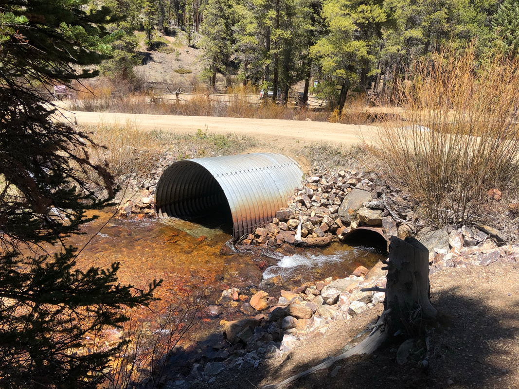
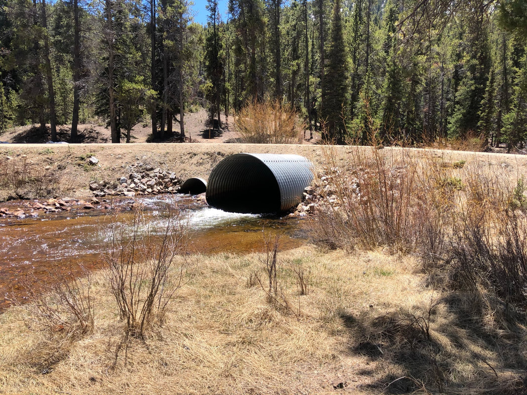
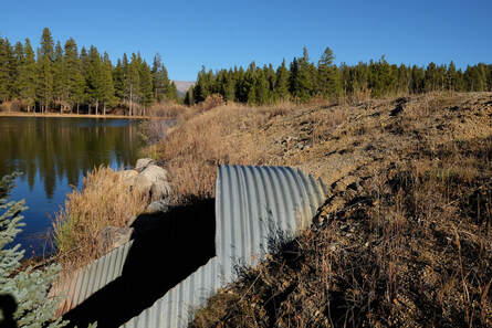
Lake County Road 3B at Evans Gulch
|
The culverts located at Lake County Road 3B at Evans Gulch are currently above the base water level of the stream, preventing fish and other aquatic organisms from passing. Evans Gulch is the drinking water source for Lake County and serves as a wild brook trout fishery. The site has suffered continued damage to riparian habitat upstream of the culverts due to flooding.
|
Two culverts will be replaced at this site. Replacement will improve stream health by creating a natural stream bottom, increasing floodplain connectivity, and allowing for aquatic organism passage. The replacement will also minimize potential debris blockage, simplifying maintenance on managers.
|
Before replacement, culvert 1:
|
|
Before replacement, culvert 2:
|
|
2027
Lake County Road 9 at Tennessee Creek
|
The culvert located at Lake County Road 9 at Tennessee Creek is currently above the base water level, preventing fish and other aquatic organism passage. Additionally, beaver ponding upstream of the inlet is causing debris and sediment to pile up, increasing the need for maintenance.
|
Replacement of this culvert will improve stream health by creating a natural stream bottom, increasing floodplain connectivity, and allowing for aquatic organism passage. The replacement will also minimize potential debris blockage, simplifying maintenance on managers.
|
Before replacement:
|
|
