
NRCS EMERGENCY WATERSHED PROTECTION PROJECT IN BIG COTTONWOOD AREA
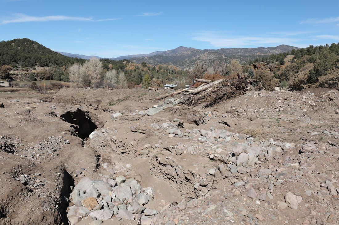
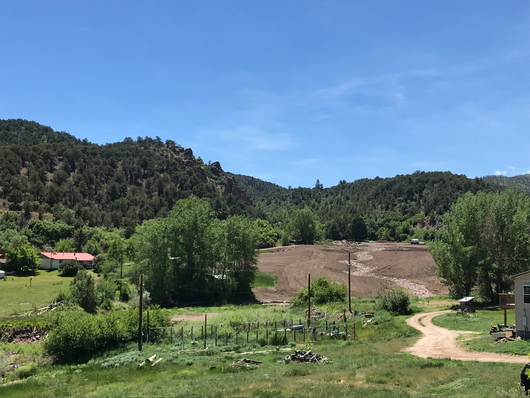
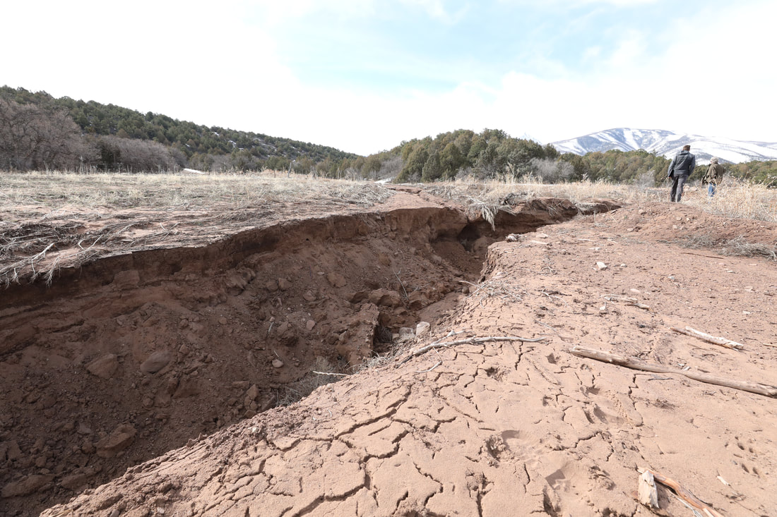
The Natural Resources Conservation Service Emergency Watershed Protection (NRCS EWP) brought much needed recovery work to the flood-impacted Big Cottonwood area in Coaldale. For two years following the fire, resources were sparse. After the July 24, 2018 flood, the need for mitigation work in the drainage became urgent. The grant program helps communities address watershed impairments like floods that pose immediate threats to life and safety. The project focused on the upper private reach of Big Cottonwood, near the confluence of Big Cottonwood, Little Cottonwood and Bitter Creeks where several homes in the floodplain within a narrow canyon are threatened. Project measures included grading, channel realignment, debris removal, revegetation and installation of structures to divert water away from homes, reduce damage caused by flood-borne debris, and encourage stabilization of soils and deposition of sediment in safer areas, increasing the overall resiliency of the channel to accommodate increased flows during the post-fire recovery period.
The project was sponsored by Fremont County with matching funds from the CO Department of Homeland Security & Emergency Management. Otak Engineering designed and implemented the project, with Frontier Environmental as the contractor, with support from the recovery team's hydrology and hydraulics assessment of flooding in the drainage. Through a partnership between the Upper Arkansas Water Conservancy District and ARWC, with funding from the Colorado Water Conservation Board, a small group of local professionals formed a recovery team, now ARWC staff and partners, provided landowner outreach for the project.
The project was sponsored by Fremont County with matching funds from the CO Department of Homeland Security & Emergency Management. Otak Engineering designed and implemented the project, with Frontier Environmental as the contractor, with support from the recovery team's hydrology and hydraulics assessment of flooding in the drainage. Through a partnership between the Upper Arkansas Water Conservancy District and ARWC, with funding from the Colorado Water Conservation Board, a small group of local professionals formed a recovery team, now ARWC staff and partners, provided landowner outreach for the project.
LANDOWNER OUTREACH & NEEDS ASSESSMENT
|
|
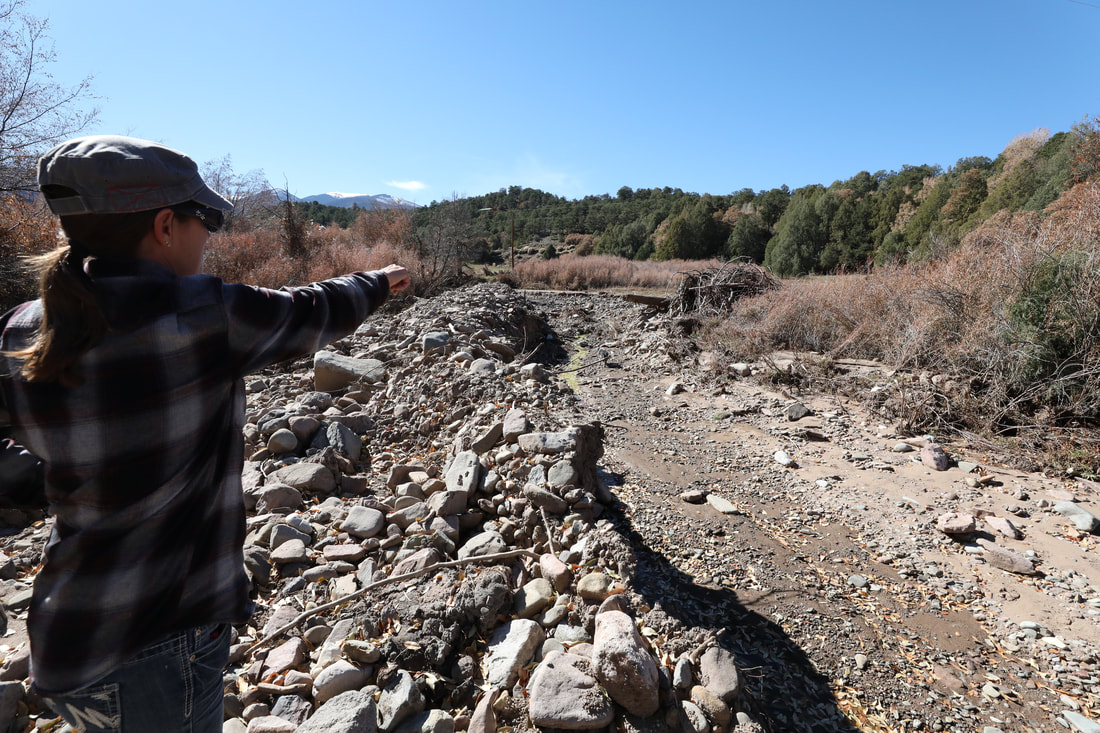
Concurrently with EWP outreach, the recovery team began meeting with landowners in all fire-impacted drainages to assess fire and flood-related needs, to inform prioritization of projects and funding decisions. While some of these needs were met by EWP, many remained for complementary recovery efforts to meet.
We brought a wide array of professionals in for drainage tours, including those focusing on immediate life/safety and infrastructure protection, wildlife habitat and fisheries restoration, water supply and infrastructure protection and overall ecosystem regeneration to determine the most effective, comprehensive approach to guide recovery activities. We also surveyed the community via open meetings and website to capture priorities including life/safety, property damage, forest and watershed health, wildlife habitat, fishing and rafting and water quality/supply and agricultural irrigation infrastructure damage.
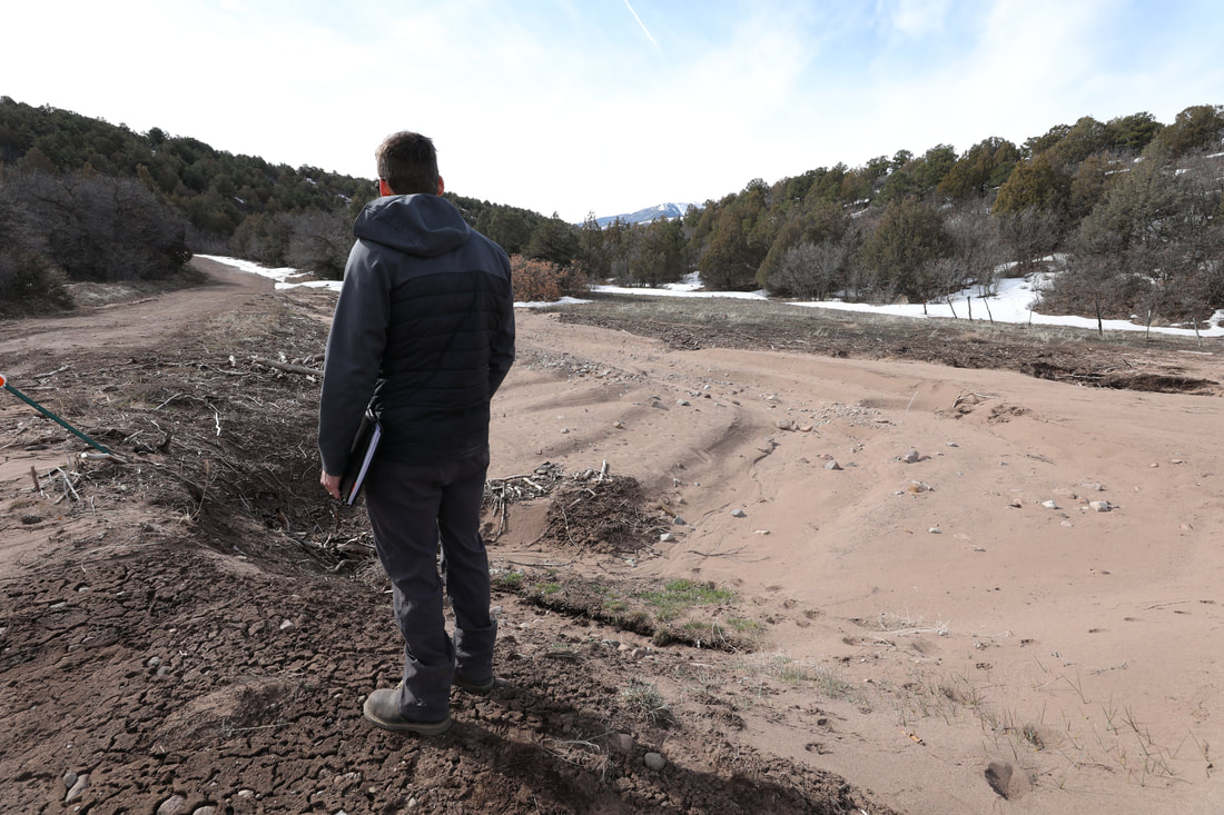
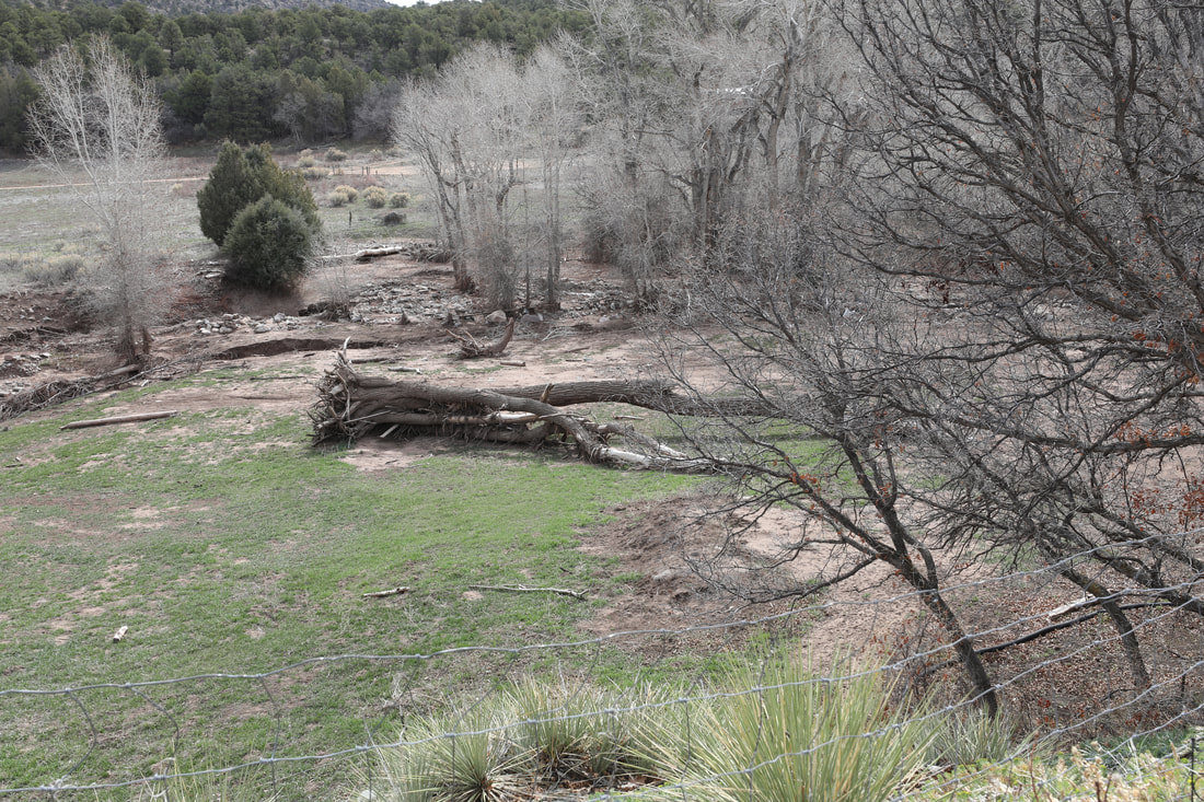
The initial focus was protecting life and homes and improving safety with every effort to enhance the health and resilience of the riparian system. The recovery team completed site visits and utilized aerial imagery to generate a map of priority projects which included an initial phase of hazard tree and debris jam removal and later flood plain and channel restoration for the riparian area. Debris removal work improved flow of water and debris through the channel and removed many hazardous materials that could cause property damage downstream, and allowed us to understand the landowner perspective. Landowners are the most heavily impacted by floods, care deeply about the land and their neighbors, and know the behavior of the creeks and drainages they call home, making them key partners in the fire and flood recovery process. We thank them for their time, patience, input and hard work. We look forward to continued work together.
We brought a wide array of professionals in for drainage tours, including those focusing on immediate life/safety and infrastructure protection, wildlife habitat and fisheries restoration, water supply and infrastructure protection and overall ecosystem regeneration to determine the most effective, comprehensive approach to guide recovery activities. We also surveyed the community via open meetings and website to capture priorities including life/safety, property damage, forest and watershed health, wildlife habitat, fishing and rafting and water quality/supply and agricultural irrigation infrastructure damage.
The initial focus was protecting life and homes and improving safety with every effort to enhance the health and resilience of the riparian system. The recovery team completed site visits and utilized aerial imagery to generate a map of priority projects which included an initial phase of hazard tree and debris jam removal and later flood plain and channel restoration for the riparian area. Debris removal work improved flow of water and debris through the channel and removed many hazardous materials that could cause property damage downstream, and allowed us to understand the landowner perspective. Landowners are the most heavily impacted by floods, care deeply about the land and their neighbors, and know the behavior of the creeks and drainages they call home, making them key partners in the fire and flood recovery process. We thank them for their time, patience, input and hard work. We look forward to continued work together.
HYDROLOGY & HYDRAULICS STUDY
|
|
|
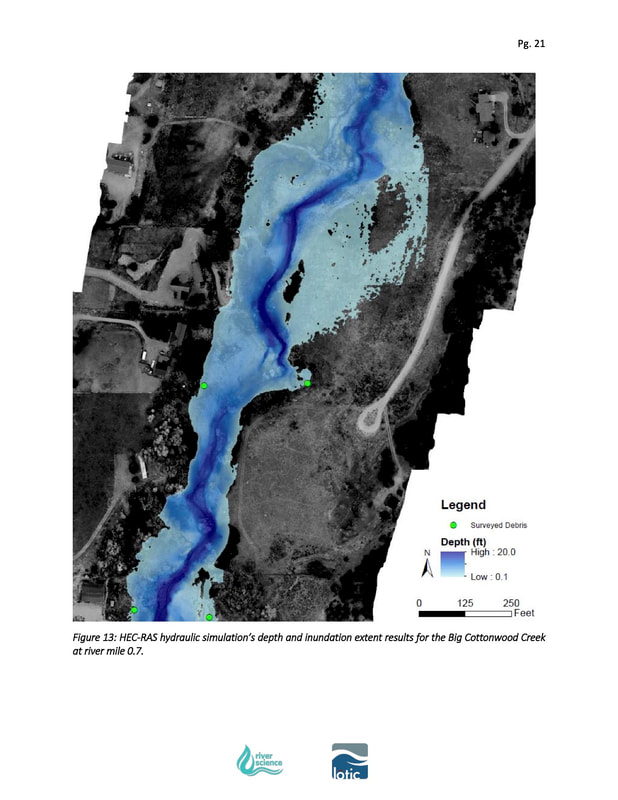
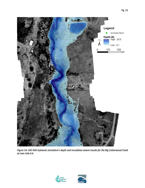
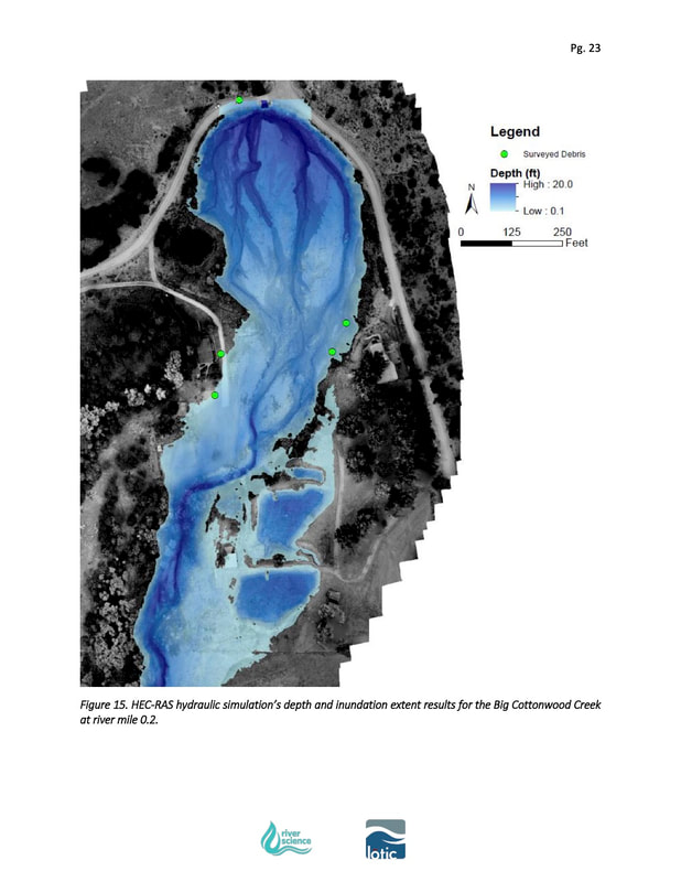
Luke Javernick of River Science and Seth Mason of Lotic Hydrological completed a hydrologic study utilizing aerial imagery to understand the extent and behavior of the extreme flow following the microburst rain event over the Big Cottonwood drainage on July 24, 2018. Read the report on our Resources page. This report provided the first comprehensive look at an actual post-fire flood event, providing a more complete understanding of this type of flow. Previously available reports were based on modeling rather than observations of real events.
This study provided detailed, relevant data to inform the design of the NRCS EWP grant, allowing implementation to better match the nature of flows specific to the drainage. The study will be used to inform later recovery activity decisions and most importantly, provided an opportunity to improve understanding of these types of post-fire peak flow events in similar topography.
This study provided detailed, relevant data to inform the design of the NRCS EWP grant, allowing implementation to better match the nature of flows specific to the drainage. The study will be used to inform later recovery activity decisions and most importantly, provided an opportunity to improve understanding of these types of post-fire peak flow events in similar topography.
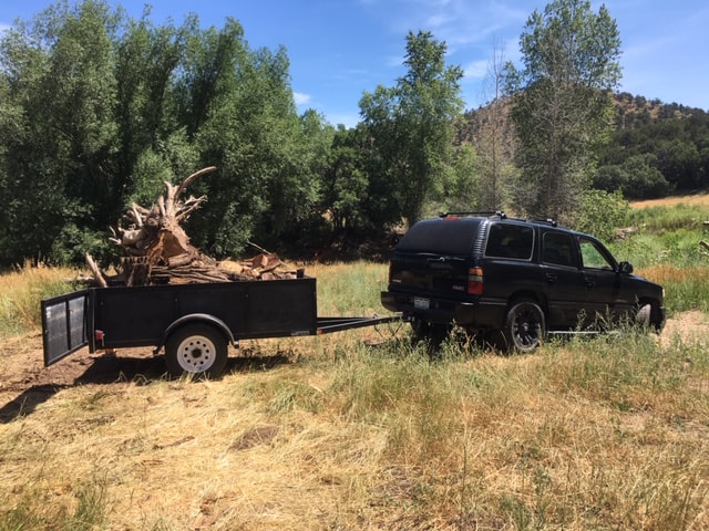
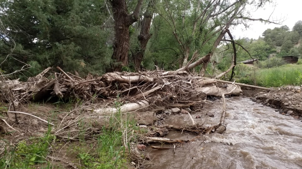
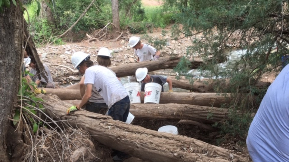
HAZARD DEBRIS & TREE REMOVAL
|
|
|
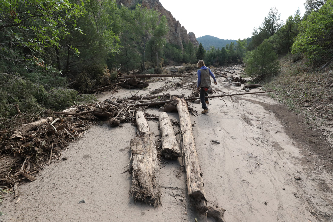
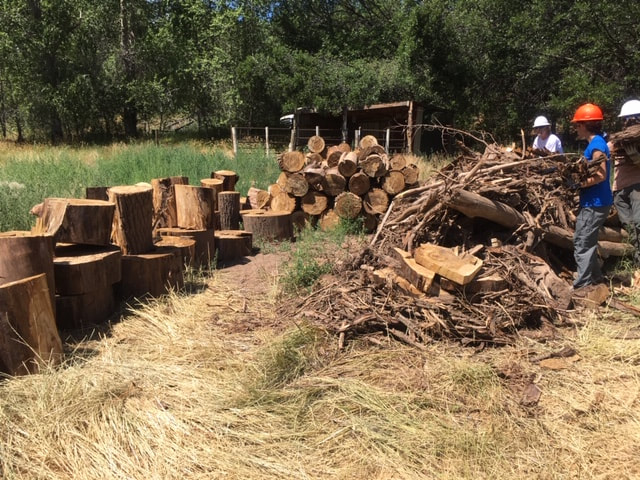
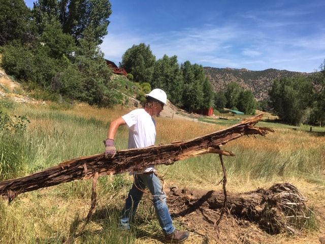
During July and August 2019, volunteer crews removed debris and trash from the Big Cottonwood drainage. The crews are from the Work Innovation and Opportunity Act (WIOA) program - part of the Upper Arkansas Area Council of Governments program in Canon City. Thank you so much to our committed volunteers who are working hard to improve conditions in the fire-impacted drainages. You can learn more about the program here: http://www.uaacog.com/programs/workforcedevelopment.html
With the help of a forester and sawyer from ARWC and crew leader from River Science, crews removed trees in or falling in to the creek from heavily eroded banks, preventing these from becoming hazards to life and property downstream during another flood event. They also deconstructed and hauled out three large debris deposits containing woody materials and trash from the July 24, 2018 flood and subsequent floods. Removing these jams and deposits allows water and additional debris to move more freely down the channel during a flood, encouraging flows to pass through rather than collecting and diverting water toward people, homes and roads. The crews removed a large amount of trash including small pieces of microtrash as well and large pieces of metal and equipment deposited during last July's high flow flood. Clearing out trash prevents these materials from continuing to contaminate the natural system, and supports natural regeneration of plant and animal communities, including the fishery.
With the help of a forester and sawyer from ARWC and crew leader from River Science, crews removed trees in or falling in to the creek from heavily eroded banks, preventing these from becoming hazards to life and property downstream during another flood event. They also deconstructed and hauled out three large debris deposits containing woody materials and trash from the July 24, 2018 flood and subsequent floods. Removing these jams and deposits allows water and additional debris to move more freely down the channel during a flood, encouraging flows to pass through rather than collecting and diverting water toward people, homes and roads. The crews removed a large amount of trash including small pieces of microtrash as well and large pieces of metal and equipment deposited during last July's high flow flood. Clearing out trash prevents these materials from continuing to contaminate the natural system, and supports natural regeneration of plant and animal communities, including the fishery.
|
|
We will continue work in fire-impacted drainages as needed with guidance from our assessment and modeling and input from landowners and professional partners, depending on changes in erosion and subsequent flow events. Contact Us with any questions, ideas, or concerns.
