
|
The U.S. Drought Monitor shows drought conditions across Colorado and the Arkansas River Basin almost identical to a week ago, with most of the Ark Basin drought-free or abnormally dry. The Drought Monitor report does not reflect precipitation from the most recent weather system that brought rain to the entire basin. 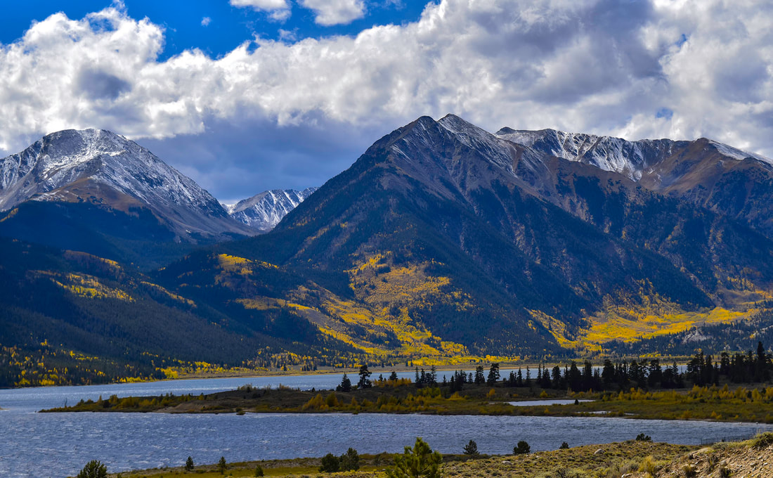 Twin Lakes Reservoir. Precipitation
The CoCoRaHS (Community Collaborative Rain, Hail and Snow) Network reports the following precipitation amounts for the past week:
Reservoir Storage The past week saw water storage in Pueblo Reservoir decrease slightly to 178,299 acre-feet – 55.2% full. Water storage in Turquoise Lake decreased to 86,200.7 acre-feet or 66.6% full, while the water level in Twin Lakes increased to 119,112 acre-feet, bringing the reservoir to 84.5% full. The U.S. Army Corps of Engineers reports the water level in John Martin Reservoir saw a slight drop to 13,054 acre-feet. River Flows Arkansas River flows increased over the past week except for in the lower basin. The flow near Leadville increased to 41.8 cfs, and the gauge below Granite increased from 187 cfs a week ago to 240 cfs. The Wellsville gauge showed a gradual decline in river flow until the rains arrived Wednesday, bringing the flow up to 432 cfs. The flow at Cañon City is currently 357 cfs, and below Pueblo Reservoir, 82.3 cfs. The gauge near Avondale reports 210 cfs, while the flow at Rocky Ford dropped to 88 cfs. Flows are 41.7 cfs below John Martin Reservoir and only 11.6 cfs near Lamar. Calling Water Rights The number of calling water rights in the Arkansas Basin now stands at 20. The Hardscrabble Ditch, with its 1860 priority date on Hardscrabble Creek, remains the most senior calling right, followed by the Titsworth Ditch on Fourmile Creek, the Hayden Supply Ditch on Greenhorn Creek, the Hoenhe Ditch on the Purgatoire River, all with 1865 priority dates. The Bannister Ditch on Fountain Creek and the Gonzales Ditch on the Apishapa River are next in seniority with 1866 priority dates. The Garcia Ditch No. 2 (1867) is also calling on the Apishapa River, and the Gomez Ditch (1868) is calling for water on the Cucharas River. Next in seniority is the Camblin Ditch on Hayden Creek and the Trout Creek Ditch on Cottonwood Creek, both with 1872 priority. Additional calls include the Hill Ditch (1873) on Howard Creek, the Risser and Locke Ditch (1875) on Grape Creek, and the Lamar Canal on the Arkansas River mainstem (1875). Rounding out the list are:
Comments are closed.
|
Archives
July 2024
Categories |
 RSS Feed
