
|
Arkansas River Basin drought conditions continue to improve, with the U.S. Drought Monitor showing moderate drought in small portions of the lower basin and drought-free to "abnormally dry" conditions across the rest of the basin. 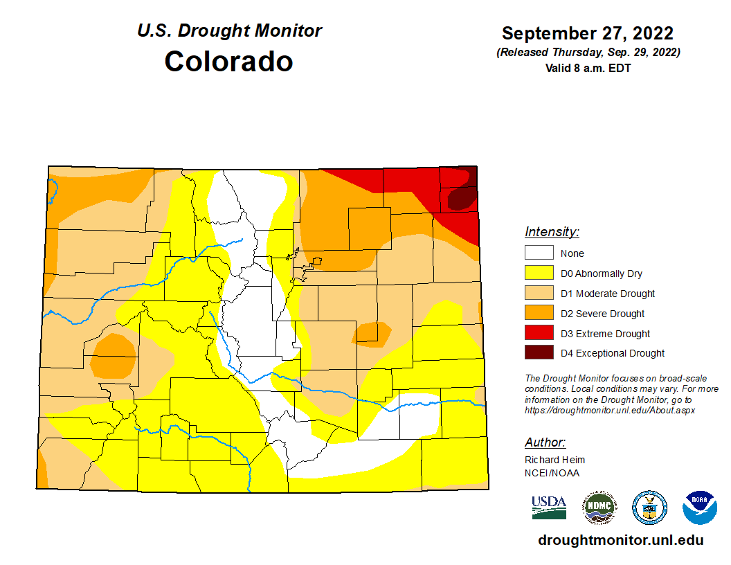 Precipitation
The CoCoRaHS (Community Collaborative Rain, Hail and Snow) Network reports the following precipitation amounts for the past week:
Reservoir Storage Water storage in Pueblo Reservoir remains the same as it was a week ago – 178,299 acre-feet and 55.2% full. Water storage in Turquoise Lake and Twin Lakes dropped by 0.1% 66.5% and 84.4% full, respectively – 86,039.2 acre-feet in Turquiose and 118,969 acre-feet in Twin. The U.S. Army Corps of Engineers reports the water level in John Martin Reservoir dropped to 12,373 acre-feet. River Flows Most of the gauges that track Arkansas River flows are reporting decreased flows compared to a week ago. The flow near Leadville steadily decreased this week to 28.2 cfs. Below Granite the river flow dropped to 180 cfs. The Wellsville gauge reports 353 cfs, down from 432 cfs a week ago. The flow at Cañon City increased into the weekend, peaking at 439 cfs before dropping to the current reading of 322 cfs. The gauge below Pueblo Reservoir currently registers 131 cfs, while the gauge near Avondale reports 233 cfs. At Rocky Ford the river is flowing at 102 cfs. Flows are 56.4 cfs below John Martin Reservoir and 34.7 cfs near Lamar. Calling Water Rights The number of calling water rights in the Arkansas Basin remains at 20, the same number as last week, with the six most senior calling rights unchanged:
The Fernandez Ditch (1868) has a call for water on Turkey Creek, as does the Gomez Ditch (1868) on the Cucharas River. Next in seniority are the Jose Maria Ditch (1873) on Huerfano River and the Cottonwood and Maxwell Ditch (1874) on Cottonwood Creek. Additional calls the Risser and Locke Ditch (1875) on Grape Creek, and the Lamar Canal (1875) on the Arkansas River mainstem. Rounding out the list are:
Comments are closed.
|
Archives
July 2024
Categories |
 RSS Feed
